Grassington to Buckden, 12.5 miles, 1591 feet of ascent (note: both numbers estimated due to path ‘detour’)
I made a dumb mistake, and it made today better.
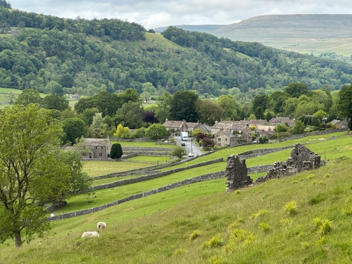
As I’ve mentioned before, I monitor the weather pretty closely, even though the forecasts are not super accurate and a matter of a few miles can make a difference between light rain and heavier showers. But Wednesday night the forecast for today looked unpromising. My 12.5 mile walk took me from Grassington to Kettlewell, where I finished my short leg of the Dales Way on Sunday, and then continued up the valley following the Wharfe for another four miles to Buckden. As you’ll know from reading Day 7, the Grassington to Kettlewell section is a climb out of town and up over the top, with no villages or even houses for more than six miles, and it had been a hard wet slog. So, rain in the forecast, a section I’d walked already, and a slog. A plan was hatched: Take the bus to Kettlewell and only do those last four miles.
I researched the buses, double checked with my hostess in Grassington, and planned to take the 10:18 bus. The 9:08 would get me there too early, and I’d be twiddling my thumbs either in Kettlewell or Buckden until 4pm, when my room would be available (I’ve found that if a B&B owner says 2 or 3, they mean they are around, but if they say rooms available from 4pm, they really mean it). The next bus, at 1:30, felt too late, getting me to Kettlewell around 2pm and forcing me to spend a lot of time in Grassington waiting.
So, with the forecast still looking bad when I arose in the morning, I had a leisurely breakfast of eggs florentine (yum) at 8:45, during which I got chatting with another solo traveler. She is from London and would be visiting friends for the weekend somewhere further in the Dales, but had decided that if she was driving five hours from London, it was worth taking a few extra days. I explained I was on Lady Anne’s Way, and when she looked blank-faced, I did a quick amateur historian intro to Lady Anne and her important role in British legal history as a tough woman who fought for her inheritance rights and, after decades, won. I felt very proud of myself, educating the British on their history.
I dawdled a bit, and walked up the road to the bus stop. Now, buses going both south to Skipton and north to Buckden use the same stop, because they come off a main road to get into Grassington and then come back out again, and my stop was along that section of back out again. The Skipton bus is scheduled for 10:16 and the Buckden bus for 10:18.
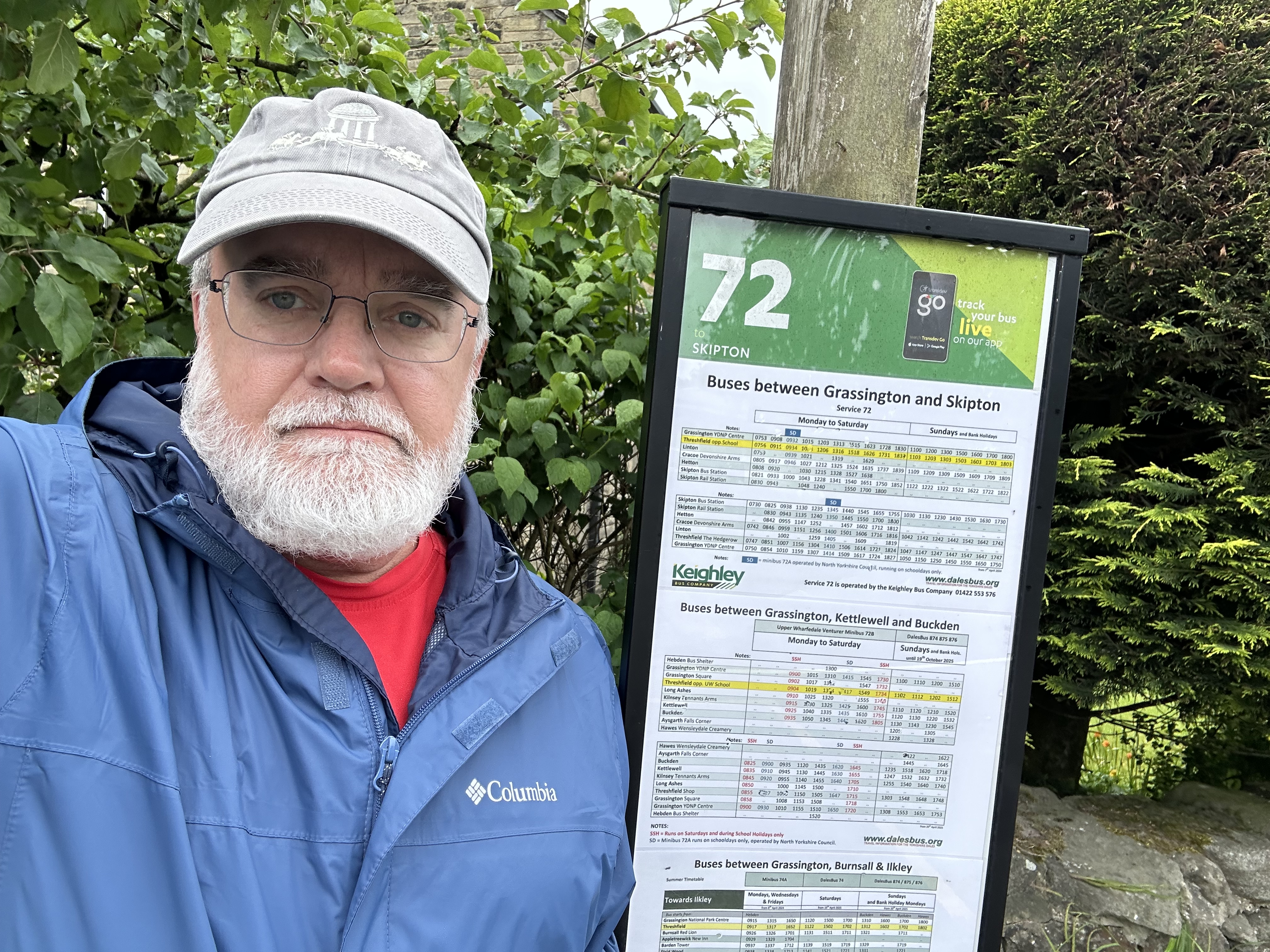
And at 10:17, just a minute late, a big bus (not a full-size CTA bus, but big enough that you get on by climbing up steps) with a digital readout saying “72 Skipton” rolled up. I shook my head, but a man had come up the lane behind me just on time, and had, I assume, waved the bus down. That distracted me slightly. Then there was a line of cars behind the bus waiting for it to pick him up. You see where this is going. Among them was a van much like the one that picked me up in Kettlewell Sunday to take me to Skipton. But it didn’t have a digital display, just “72B” (the correct route # for the 10:18), and I wasn’t aware it was in fact public transit until it was nearly at the stop. I assumed it would stop seeing as I was standing at a bus stop and the other bus had just gone by and there wasn’t another bus scheduled at this stop for three hours. But no, because I didn’t wave, the bus rolled on by.
After a few choice words while I tried to decide who was the idiot here, the driver or me (split decision), I concluded that, whether I was hiking over the top or waiting for the next bus, I could walk into Grassington itself, since the ‘main’ bus stop for Grassington is inthe village square, and decide there. Off I went.
Well, it wasn’t raining and the sky looked okay, and I hated the idea of sitting in a tea shop or the square for three hours, so I decided to hike. It’s the same thing I just hiked the other day, easy peasy lemon squeezy.
When I got to the top of town, where I saw the horse on Sunday, I noticed that there were two signs, one going left for the Dales Way and one going right for Lady Anne’s Way. Heck, I said, I am on Lady Anne’s Way, and it’s marked. I can vary my route.
I should note that in my pocket I had the guide pages for the Kettlewell to Buckden section, and in my pack in a plastic bag I had the Ordnance Survey map #2 for my walk, which cuts off, yes, just north of Kettlewell, so I had no map or directions. NOW we know who the idiot was at the bus stop.
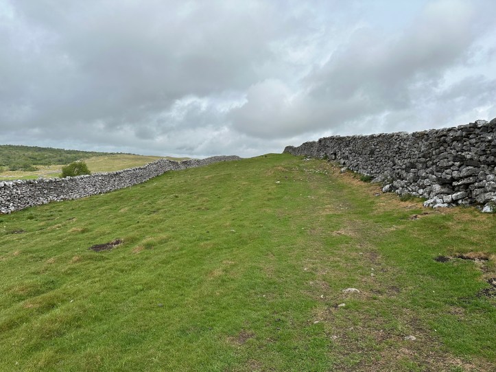
The weather was in fact fine, and though I started in my rain jacket, I soon took it off since there were only occasional rain drops. And the trail was clear and had way markers.
I think you can see where this is going. There are key landmarks on Lady Anne’s Way in this section, one of them being an old abandoned farm called Bare House. But I hadn’t read these trail directions, and I was on a path that seemed clear through the fields.
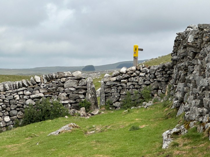
Yup. Somewhere I didn’t veer off to the right and instead went straight, and I missed Bare House, which means I missed the sharp right to get up to the main path that Lady Anne’s Way takes all the way to Kettlewell. I was ojn a footpath, but with no way markers. I kept on, but after a while with no markers, I began to wonder, so I looked at Apple Maps on my phone, and it shows a footpath where I am, so I figured I was fine. I could see the Dales Way far to the west across a dip in the top, and even saw walkers on the Dales Way.
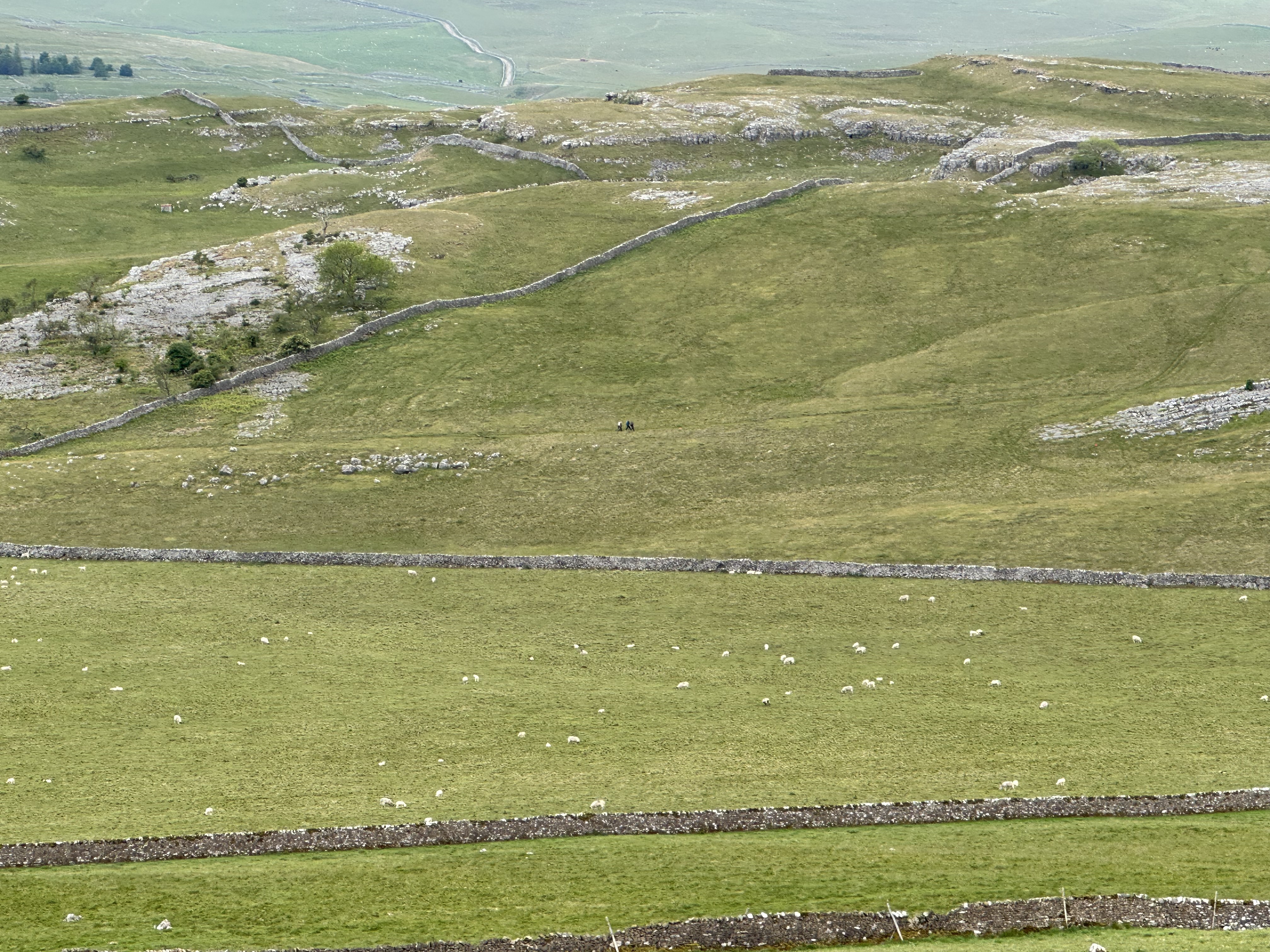
And then my path just sort of… petered out. I looked at Maps again on my phone (something I try to avoid ever since my friend Frank told me that when I started using the OS Maps app in Wales, he was sure it would ruin my blog because I am funnier when I am lost… laugh it up, Frank.). Hmm, there did seem to be a footpath, but the GPS showed me off it by twenty or thirty yards. But GPS on the phone in the wilds can deceive you. And that thirty yards would put me on the other side of a stone wall, so that couldn’t be right. Until I realized it was right and I had come to the end of a field with stone walls in front of me, and down the hill to the west of me, and no stile or gate.I looked over the wall, and there was something that looked pathlike. I figured I must have missed a turn (little did I know) and that must be Lady Anne’s Way, (Reader, it wasn’t).
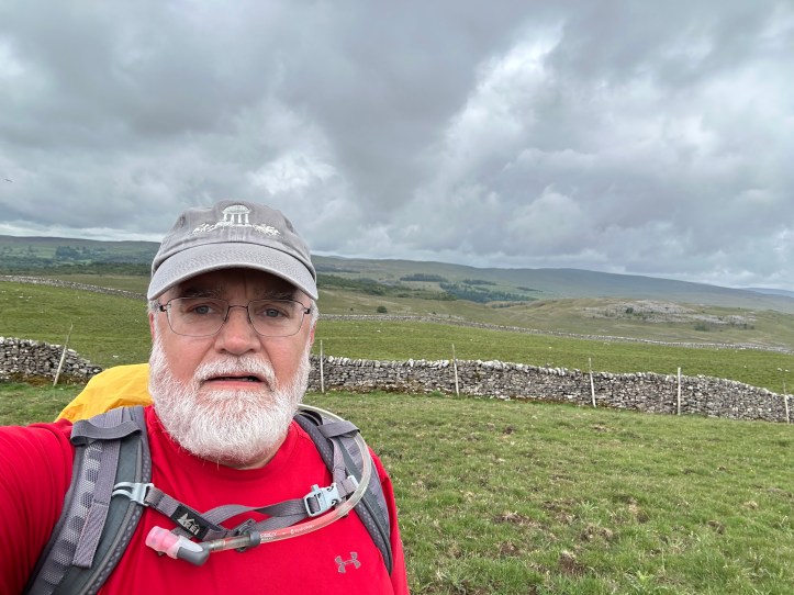
So I did what you should never do, especially when alone, and hiked down to the corner where it seemed safest to climb over the wall, topped with a bit of barbed wire for good measure, and made my way over the wall. I am happy to report I survived. And from here, the Maps app had me right back on an actual trail, and one that hooked up on about an eighth of a mile with the Dales Way.
A bit shaken, but now confident, I strode forward. I was passed by a man in his fifties I’d say, and because he passed me at a stile, we exchanged a few words about stiles being the hard bit, especially when they are wet, as they were from the little bits of sprinkle that had been happening on and off (never rain, damn the forecast, but sprinkles). The accent and the fact that he was hiking in shorts like me, tipped me off that he was an American. He said he was also headed to Buckden.
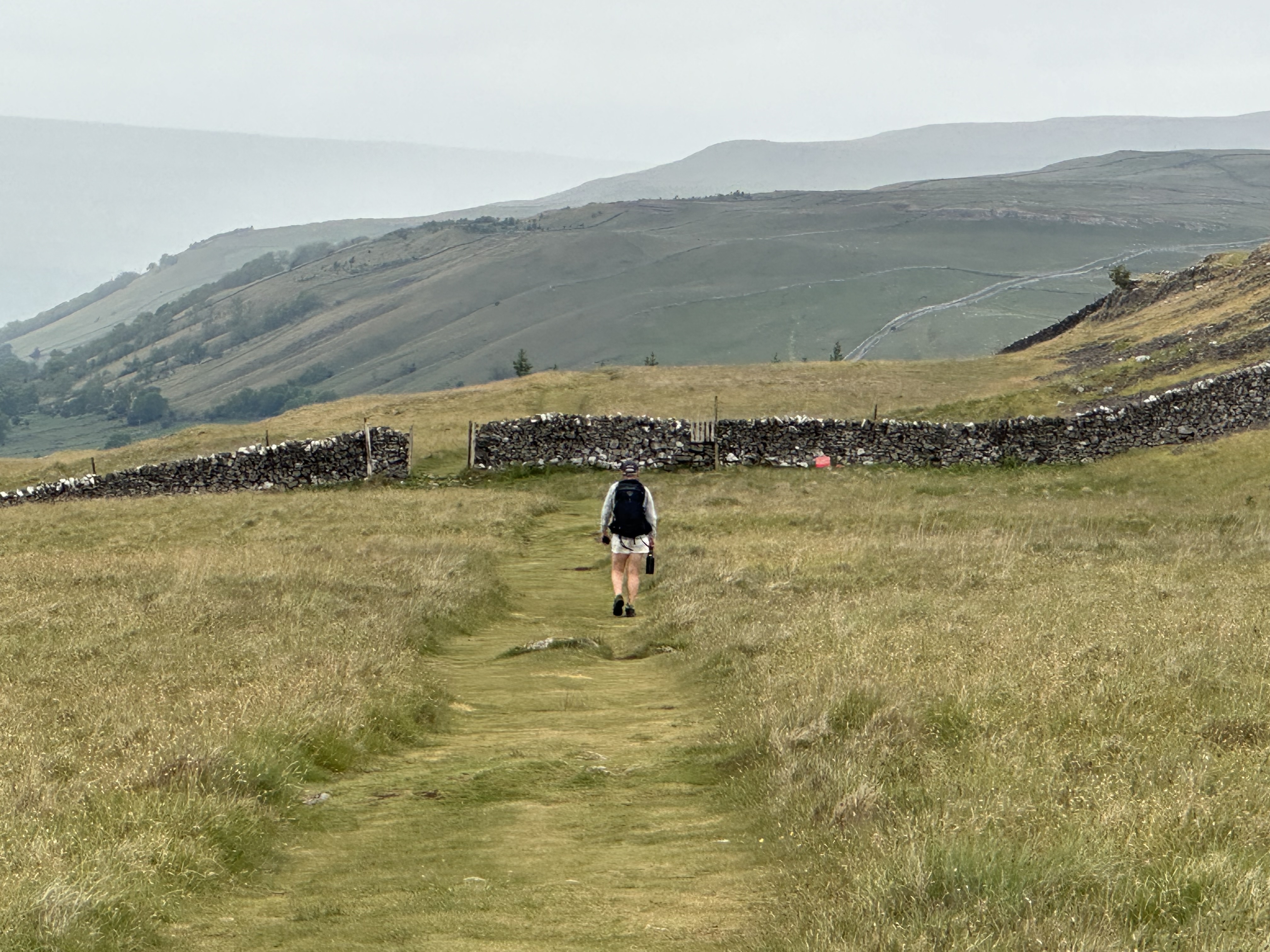
He was faster than me, so off he went and I figured I might run into him if he stopped for a rest in Kettlewell. But I thought ‘jeez, I should have mentioned to him the fourteen stiles before Kettlewell, and that you can avoid them by taking the paved road. Oh well.
A few miles later, there he was, stopped on the trail eating his lunch. So I stopped and gave him my tip about how the Dales Way gets on a paved road, then turns off it to go through field after field after field for the last .75 miles to Kettlewell. He thanked me for the tip about the road. And off I went while he ate his sandwich.
Well, I may have been a dumbass about Lady Anne’s Way, but I was right about the paved road. It got me into Kettlewell faster than the fourteen stiles over stone walls. I stopped at the village shop and bought a Diet Coke to celebrate my having survived my mishap. Then off I set for the last four miles. This section, for which I had the maps and trail description, is straightforward, climbing up the hill a bit to avoid people’s fields, but not climbing all the way to the top. So you can see the Wharfe below to the west as you amble north over a path that is mostly dirt with some bigger rocks mixed in just to keep you paying attention and making micro-adjustments to your stride with every step. Tiring.
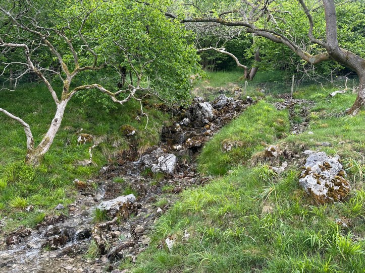
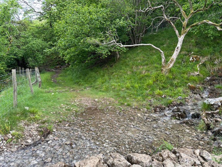
And then the path dipped down to the village of Starbotton to cross the river and follow the right bank for the last two miles into Buckden. By now, about 10.5 miles into my walk, my feet were sore and I was tired and my pace was slowing, but I didn’t really want to stop with so little left to do. And the path is pretty.
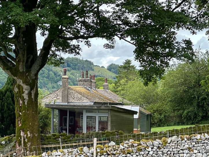
Cool little modern studio building totally different from any other house around here. I want to sit in there and read a book. 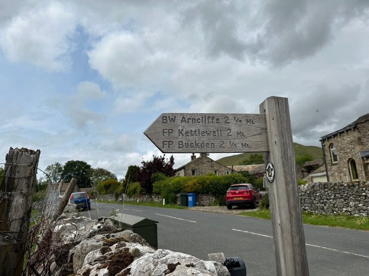
Not too much more… 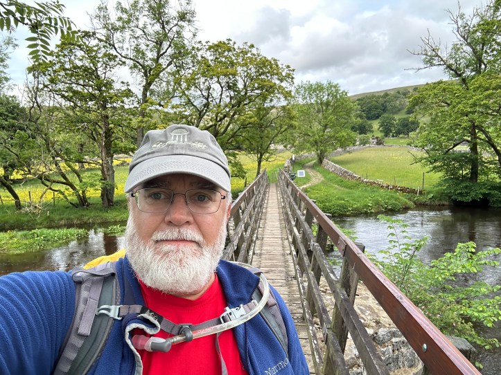
Crossing the Wharfe to get to the western side. 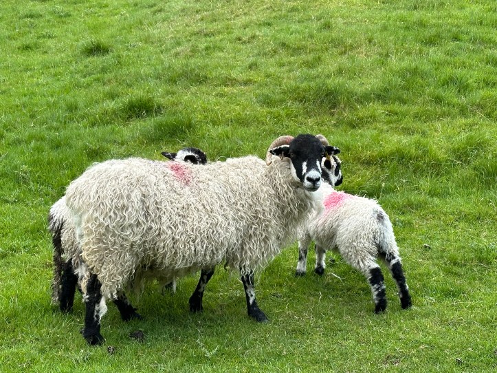
They really didn’t want to leave the path, and only gave up a few feet. 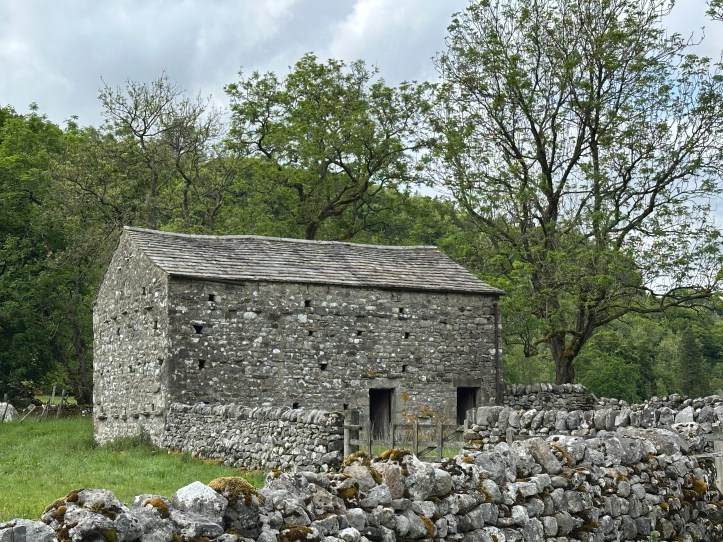
Check out this barn with so many openings for birds. 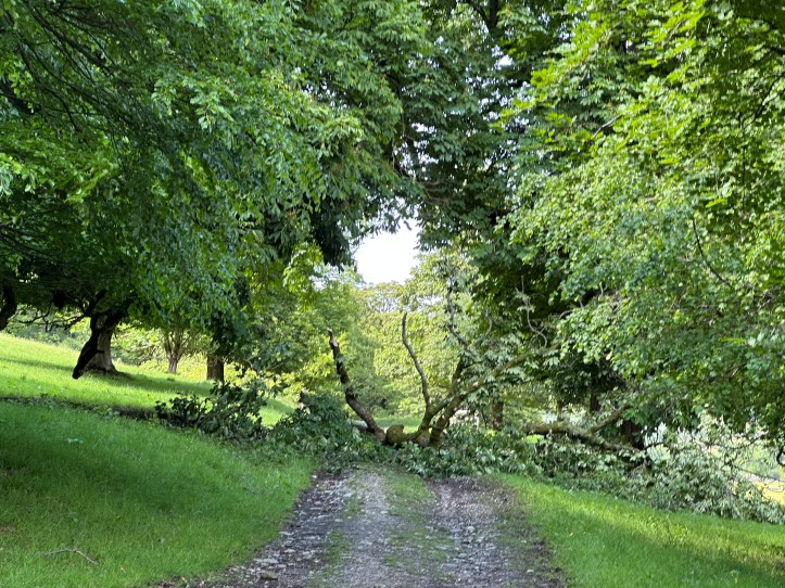
Big branchfall on the path. 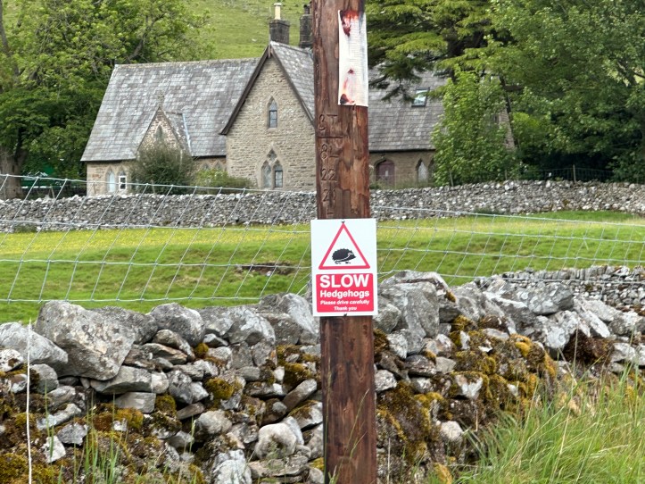
My arrival in Buckden, where drivers are warned to drive slow for hedgehogs.
It was an exhausting day, more so because getting even a bit lost makes you tired. But my B&B is beautiful and my room has a vast queen-sized bed and a bathtub and separate shower. So I indulged in a bath right after I got here, and then broke out the maps and guidebooks to try to figure out what the heck happened with the path that I missed. That’s when I understood that I had veered off Lady Anne’s way pretty early out of Grassington, and hadn’t been on it for miles of my trip across the top. Oh well, I made it. What an adventure.
Notes for a script: The Buck Inn, the only place to eat and drink in Buckden, was hopping at 7:45 on a Thursday, with a shocking number of American accents (more than I have heard all trip- maybe ten people I heard and tagged American). There was a group of five, or maybe six, American men (they kept moving around checking out the bar and the restaurant area like they were assessing a property, and they all had the same sort of vibe, so it might have been six, but was at least five). Middle-aged (35 for the youngest, maybe 50 for the oldest), giving off a distinct investment banker or stock broker vibe (two with carefully manicured beards and shaved heads, one with an Oakley baseball cap worn backwards, one with leonine hair and tortoise shell glasses that suggested he was trying for the full mid-career Graydon Carter effect). Not tech bros; they didn’t, as tech bros do, give off that certain messianic/maniacal shimmer, born of the conviction that the work they are doing will transform, or possibly destroy, the world. This pack of semi-alphas in the Buck Inn, it seemed to me, had never used ketamine recreationally. So not tech investor bros.
They’d all clearly been out walking; shorts, a general sweaty look, the fact that they were assembling at the last second before the kitchen closed at 8pm. It was a definite drama in which they assumed they were the main characters, getting their food order in before that damn kitchen closed.
So I started scripting a movie in my head, in which a group of investment bankers from America go on a team-building/reward trip to hike in the Yorkshire Dales. And then things go wrong. I don’t think it’s horror or a thriller with evil locals pursuing them. It’s more just the way their sense of world-owning entitlement, put up against the hills, turns them against one another. I think I have something here.

I misread the town name as Starbottom.