Burnsall to Kettlewell, 9.5 miles, 945 feet of ascent
I had a lovely rest last night, and then woke up early to write the day’s post. (For those who don’t know me, I rise early and have for most of these rambles written about the previous day at 5am, before getting breakfast. I am making mental notes all day and through the evening, so it’s mostly just banging it out on the computer.) Then eggs Benedict before my taxi came to my lodging in Linton to return me to Burnsall to start my second and last day on this little inter-walk on the Dales Way. I’d been looking at the forecast, which called for a dry morning but lots of wind, and rain in the afternoon for a few hours.
This is perhaps the right moment to say that though I am sure the weather forecasts in the United Kingdom are created by seasoned professionals, any UK forecast should be looked at with a healthy dose of skepticism, especially if it says something like “light rain in the early afternoon.” That could mean a light misting around 1pm, or, as was the case today, intermittent five-minute bursts of rain mixed with light misting starting at 10:30am and spread across the next three hours, which are of course prime walking time. With the Atlantic Ocean’s influence only partly tempered by passing over Ireland, the weather here is just really variable.
But the day started with a taxi ride back to the Red Lion in Burnsall, where I stopped walking yesterday. Of course, the taxi ride involved discussion of weather, and the driver asked if I was somewhere dry for yesterday’s downpour. ‘Downpour?’ I asked. Certainly there had a been a few misty bits, but nothing that made me even think of my rain jacket. He assured me that there had been a serious squall for about fifteen minutes, and we concluded that it must have been pretty localized. He shrugged and muttered something about micro-climates and left it at that.
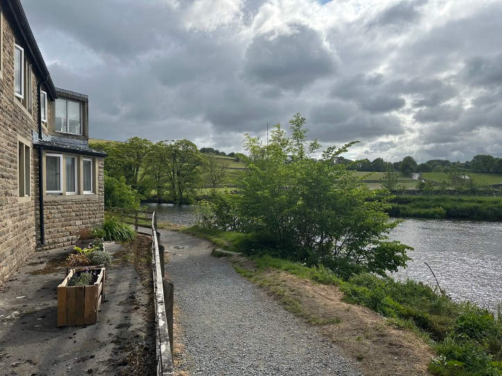
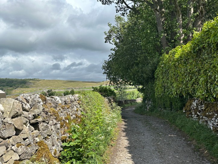
At the Red Lion, it was cool enough that I briefly debated putting on my lightweight fleece before setting out. But I tend to warm up very fast when walking, so I set out in shirtsleeves. The walk today is geographically neatly divided in two: following the River Wharfe up to Grassington through the beautiful river valley for about three miles, and then the long hike over the top of the hills with no villages or roads or houses for about six miles.
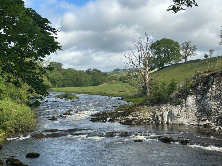
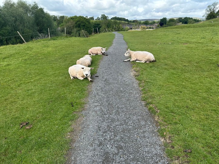
So, a riverside path, some kissing gates to control sheep access every once in a while, the occasional rocky area in the river to make it sound more musical. You get the idea.
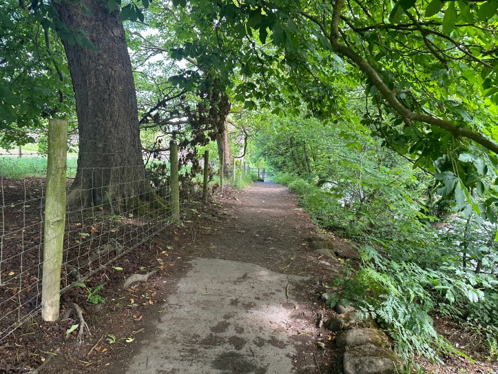

It was lovely walking, and this being Sunday, people were out on the path just going for a walk. There were also little surprises, like these two women swimming in the river.

Early in the walk, I could hear people behind me calling out for their dog, and I could tell they were gaining on me. Soon, a lean black lab with a ball in his mouth ran up alongside me, looked up at me expectantly for a second, and then turned and ran back, clearly disappointed that I hadn’t thrown the ball for him. And then it happened again. And again. As his masters got closer, I could make out his name in their call: Stanley. Now that’s a good dog name.
Eventually they caught up with me and passed me, and for the next mile or so I watched as they walked a bit while Stanley ran ahead. He’d come back to them and one of them would hurl the ball ahead, and Stanley would burst forward like a bullet. Occasionally, feeling a bit rascally perhaps, Stanley would go off the path and plunge into the river. He was a very happy dog.
The path crossed over to the left bank via a very narrow suspension footbridge. In the middle, I could feel the spring of the bridge in every step, a nice little adrenaline rush without any real danger.

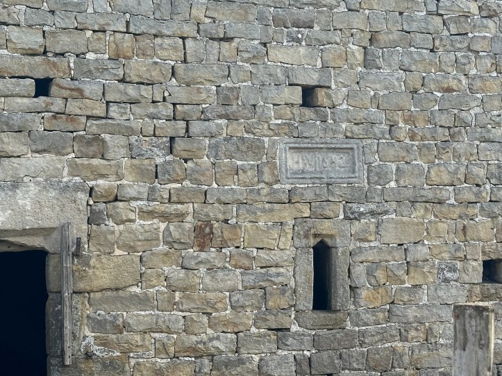
Eventually, the path left the river, turning to ascend a hill at a barn apparently built in the 1600s. Well maintained, or rebuilt, that’s for certain. After a long hard climb, I found myself in Grassington, which looks like another nice little Yorkshire village built into a hillside above a river.
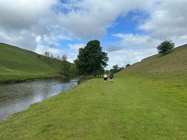


At Grassington, the pleasant walk that recalled yesterday gave way to the more invigorating second part of the walk. You should read the word invigorating with a bit of extra emphasis. It’s one of those walker code words. It means challenging in some way. In this case, it was a mix of wind, which as blowing pretty steadily but gustily at speeds up to 30 mph, and the high barren nature of the path, which for the first mile had a few confusing forks without markers where I had to do a little map reading. And later, invigorating meant cold rain blowing sideways. But hey, it’s only five and a half miles, right??


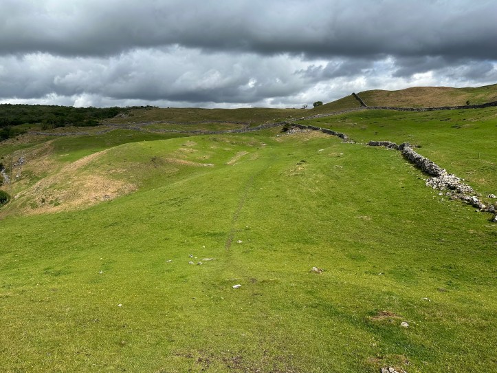

No more people walking their dogs. No more idyllic water babbling over rocks. This is rugged walking, with my left pole blown into my leg when I swung it in my stride. I actually had to adjust the way I was moving my poles to stop banging myself.
I was reassured by meeting a group of six teenage girls coming the other way with big heavy packs. I assume they were at the end of a trip for the school holiday week. They were all wearing rain gear. I was still in short sleeves.
Then I came up on an older couple, and we stopped very briefly to say hello as they let me pass them on a rather rocky bit of the trail down to a stone wall (even on these barren high lands there are walls). I foolishly challenged the gods by saying “I think the weather will hold for another hour before it rains.” They stared at me with expressions that said they worried a lunatic had been let loose on the hills. They were clearly right.
Fifteen minutes later the hard cold rain began, blowing at about a 45 degree angle. I stopped and got out my rain jacket and headed on.


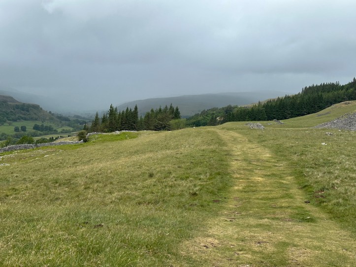
The thing is, once you are up on these high hill trails, walking along the top, it’s not like you can say “I’m going to quit and catch a bus.” The only way out is through. So, onward. And in a particularly wild bit where there hadn’t been a stone wall in a good while, the path goes by this lime kiln. Why here in particular, I wondered. Why not somewhere lower down, or at least close to a path down off the hills?


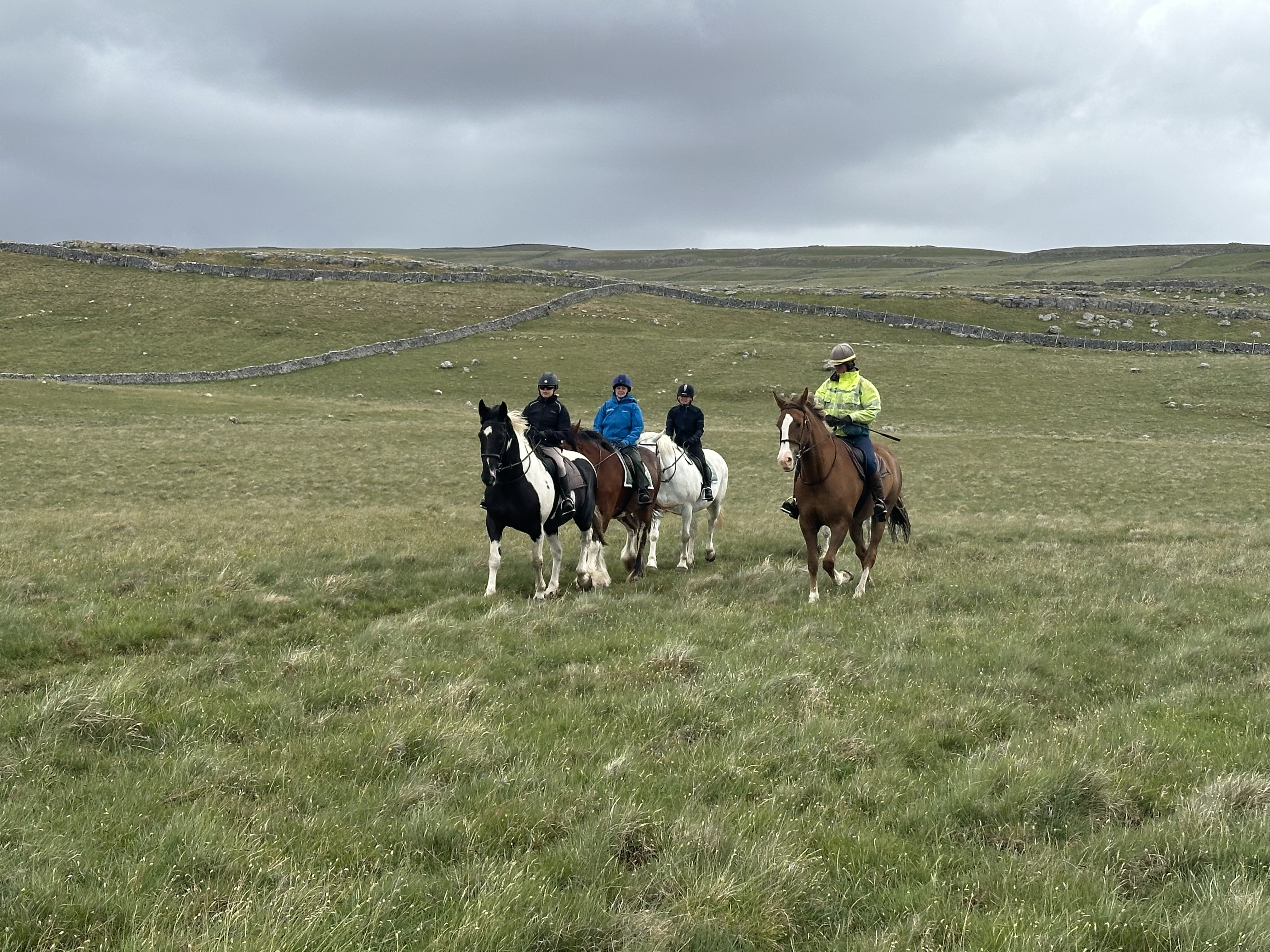
After this particularly wild stretch, the path got back to the world of walls, and I encountered a group of horse riders. There are white plastic flag markers every few hundred yards up the hill to the right and over to the left on a path I presume goes down. Not a day I’d have chosen to ride, but I am sure they looked at me and thought ‘not a day I’d have chosen to walk.’
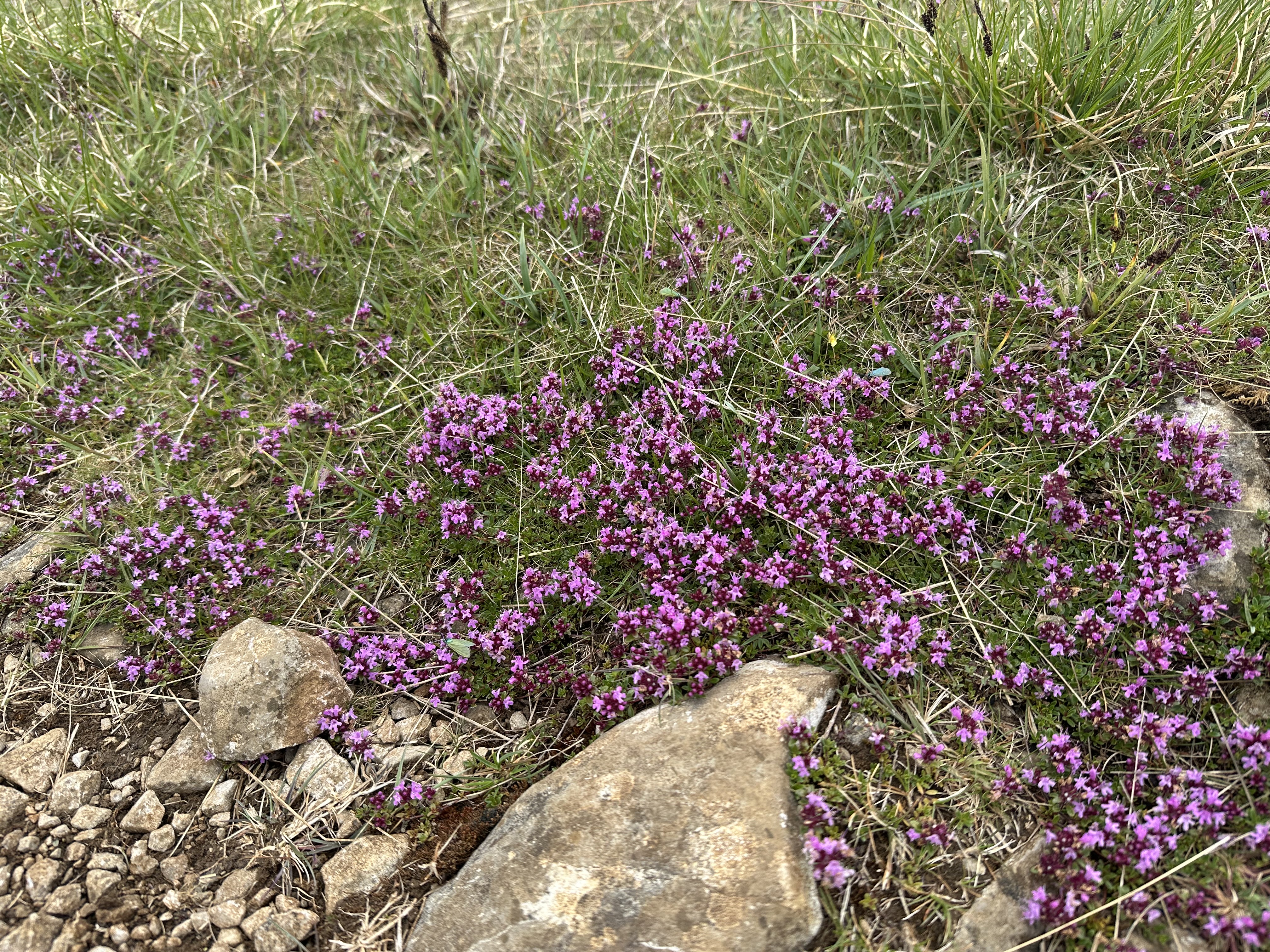
There is something especially tiring about hiking in the rain on a path with some rocky bits (slippery when wet) and lots of grassy areas (sometimes mucky when wet, sometimes just slippery on the downhill bits when wet) and hard-packed dirt (given to forming muddy puddles when wet). It makes you feel like a goddamn hero when the walk is done, but the weather slows the pace, and while it gets the blood pumping and reminds you you are alive and all those other ridiculous bromides people toss around about unpleasant things, it just takes a toll. But I still had the energy to stop and photograph flowers.
Finally, when all hope seemed lost and I figured I’d become a ghost wandering the hilltop trail warning walkers of their folly, the path started to come down and reached a stand of trees, which I knew meant I was within less than two miles to Kettlewell. I was back in the land of trail markers and sign posts with mileage on them. Alas, each sign post gave me a mileage just a bit more than I hoped. I’m thinking ‘surely this is 1 mile from Kettlewell,’ but the sign says 1.25 miles. Then I get to a paved road, certain it will be .5 mile to town, but the sign says 1 mile.


And then the Dales Way marker directed me to leave the paved road, which was clearly going toward town, and instead pointed me off into the fields on the right, which would also get me to town, and on a grassy path. Oh, sly sneaky Dales Way.
Stiles. Jesus wept, so many stiles. For some reason, in the last half mile before Kettlewell, I went over 14 stiles ( I may have lost count…).

Look, I know it doesn’t look like much, to climb up a couple of stone stairs and wrangle yourself through the gap and climb down a couple of stairs. But after nine miles of walking, on wet stone steps, every time was giving me flashbacks to all the core work I did with a personal trainer over the last eight months getting ready for the walk. It seemed like overkill at the time, climbing onto and off the bosu ball over and over again, but my thighs and glutes and abdominal muscles are telling me I should have done more.
At long last the trail gods relented, and I was in Kettlewell, a town that has two inns with pubs, a little ice cream shop that has no seating, just a service window at a little stand, and the &Then Tasting Deli, which put me off by the cutesy use of the ampersand with no space between it and the word then. Another time, I might have stopped in, but it was still raining, now lightly, and I was done for the day, a drenched trail rat getting horrified looks in the pub where I had a cider to allow time for my room to be ready.
It will surprise exactly no one if I report that two hours later the sun was shining.

That’s a nice area
I am loving the photos and the words. I can almost feel your legs going over all 14 stiles.
So am I, the next morning!
Another favourite. Next time you are in Grassington, take the moor road out of the village for about three miles. You come to the old lead mines – it is a huge area, some excellent walking and very interesting too. Worth the long detour but you could easily spend a day there. Great photos of this walk ☺️
You had to adjust your pole to stop banging yourself. No wonder you were tired.