After yesterday’s short but somehow very long wet hike, we spent dinner reassuring each other that we had done the right thing to do a little walking. As my other sister Karen noted in the comments, two miles might have been sufficient, if only there had been a workable two-mile segment. Oh well.
I’d read the description of today’s hike, from Llan Ffestiniog to Penmachno, on snowdoniaslatetrail.org, and has horrified to find this 13.2-mile section described as “certainly the toughest of all.” Would we require supplemental oxygen and climbing gear? Would we have to confront a dragon and solve a wizard’s riddle? Would there just be single continuous forest of ferns and nettles? What did it mean that our B&B at the end of this day is The Ferns Guest House. That seems like the trail teasing me.
We did not fact require supplemental oxygen (though there were several uphill bits where I wouldn’t have minded it, as long as someone else carried the weight of the oxygen bottle). We did not fight a dragon or solve a wizard’s riddle. And the fern forest… was not continuous. I would say that Tracy and Tim now fully appreciate my dread of bits of trail that go through overgrown ferns.
But in fact, the day was glorious, if soggy underfoot (I changed my socks in the middle). And the rain from the last 36 hours had made the waterfalls this day includes at its start into a stunning display of raw power.
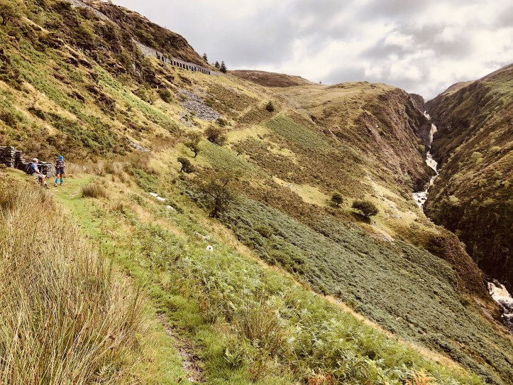
A descent to and then climb up through the Cwm Cynfal gorge provided a long exposure to water now made brown by all the dirt displaced into the rivers and streams. We paused a number of times in disbelief as the series of falls in this steep gorge just kept going as we hiked up the occasionally scary path to get to the top of the gorge. There were little surprises to remind us that this was a well-trodden path, popular because of the power and beauty of the falls.
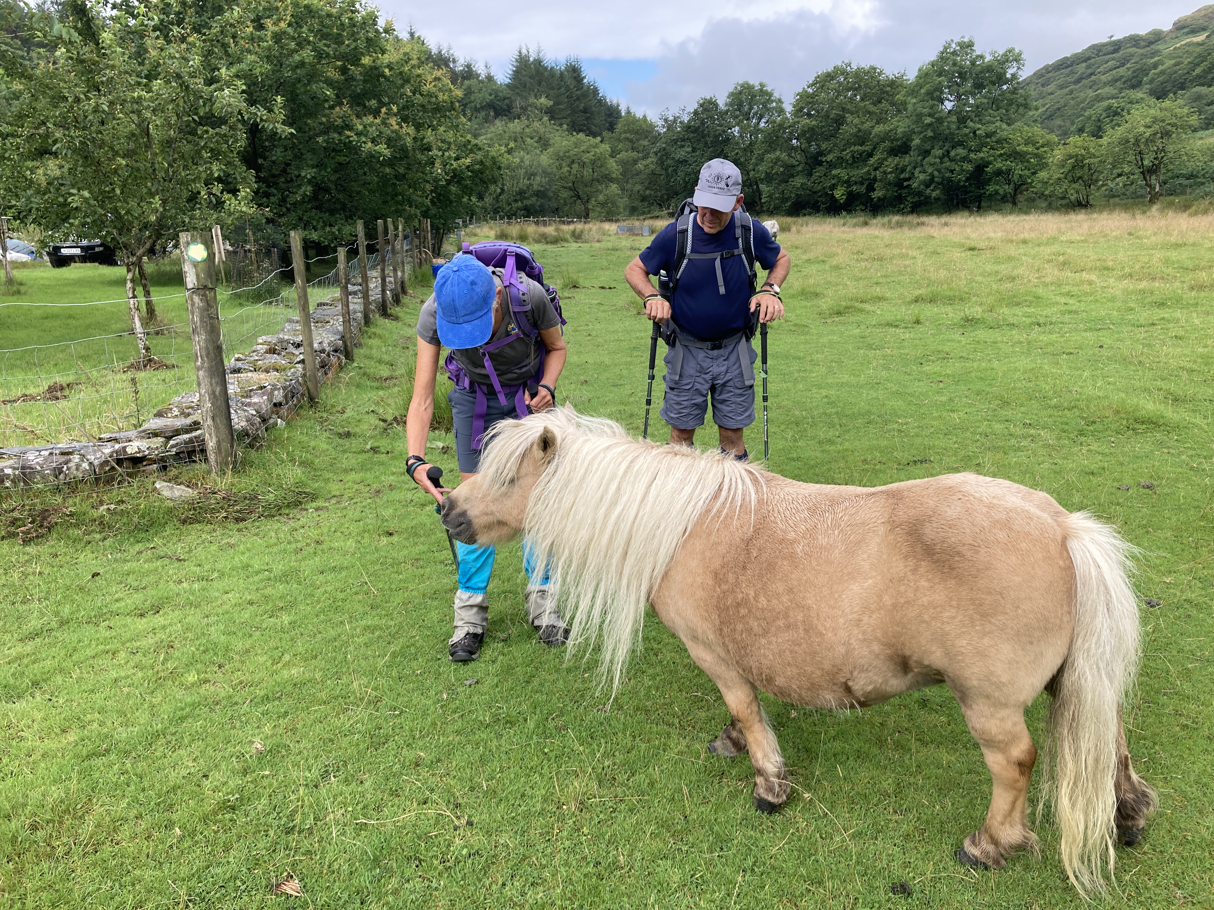
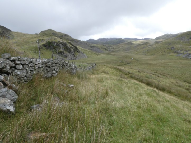
We came out of the gorge, but were still deep in a valley, which the trail is hellbent to get you out of. This is the first part of why the day is called hard on the website: the overall ascent for the day is 2850 feet. So, the trail winds up until reaching a very old farm (the post at the gate claims 1492, but the guidebook scoffs that that number is off, by at least 50 years…), where, before facing a very steep climb, we met some adorable tiny Welsh ponies.
Then we got to the first real challenge (the gorge had been a lot of quick down and then a fair bit of up, but this was a different category.

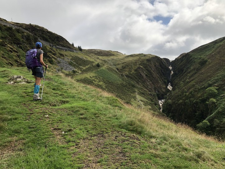
In that first image above, you see Tracy and me ascending, and off in the distance in the upper right is the farm we were just at, with the adorable ponies. To get to this somewhat ferny section, we’d gone through about fifty yards of very steep, very unclear path through fern hell. Supplemental oxygen please.
It was somewhere along in here, when I was apologizing for the hundredth time for my slower pace on the uphills, that Tracy reminded me of a very good motto. You have to hike your hike. You aren’t trying to prove yourself against a standard pace or time, and if you need to slow down, or stop and stand panting and gasping halfway up a massive ascent, do it. If you have to suddenly discover an urgent need to take a photograph in order to get a moment’s respite, do it. Hike your hike.
The next section of the trail had been ominously described in both the guidebook and on the website, and we should have paid a bit more heed to that. By now, my still fairly wet boots were getting wetter, but we were about to plunge across “the wild, open and sometimes boggy moors of the Migneint.” The guide notes that waymarking was sparse in this section. We confirmed both the bogginess, squishing and squelching along and several times going up to the tops of our boots (and over, alas) in water. We also confirmed the sparseness of the trail signs. This was a very good day to have the OS app– there were several genuinely baffling moments where the only thing that kept us going was the assurance of the app that we were on the trail. There were the low delights of waterlogged trail made worse by the heavy rains of yesterday, and there were the high delights of bashing our way through chest-high ferns. Sometimes we got a bit of both, with the path following a newly formed runoff stream up through overgrown ferns. Ah nature.
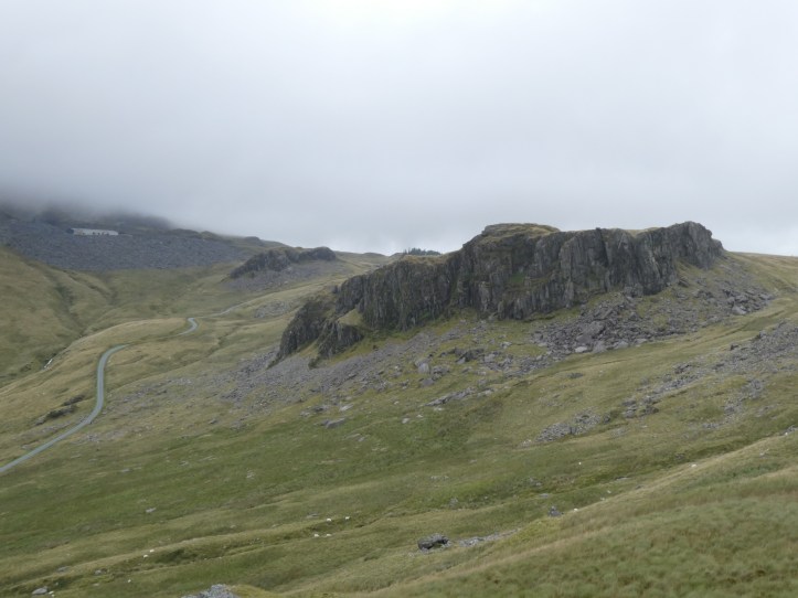
And, as we eased our way around a series of ridges and climbed still higher out of another higher section of this massive valley system, we had stunning views.
Finally, we reached the last of the aggressive uphill and bog walking, and after changing my socks at a rest stop, I had ten minutes in which my feet weren’t wet. Take what you can get. Hike your hike.
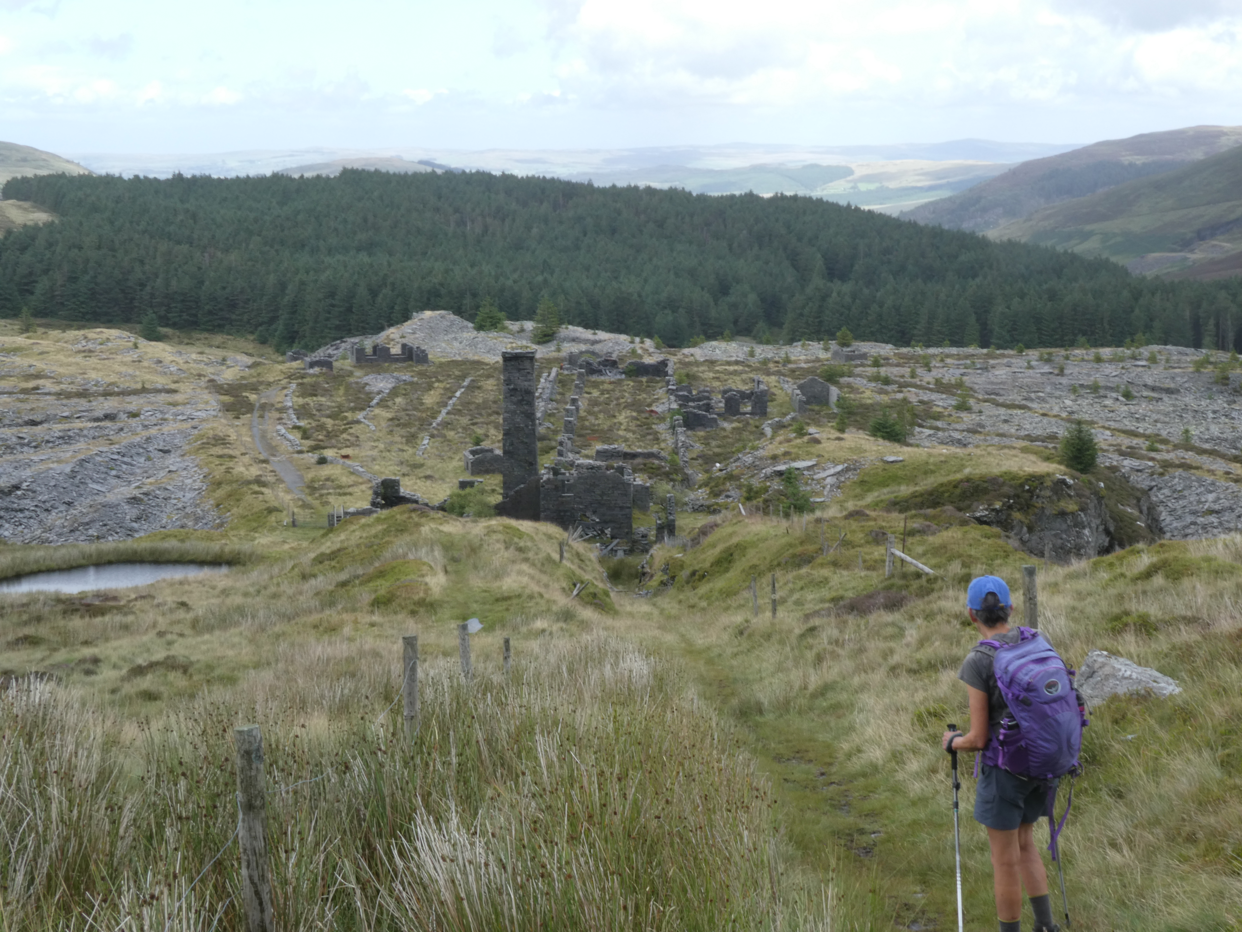
The trail then eased down past the ruins of an old slate working, Rhiw Fachno quarry, which is incredibly vivid in its illustration of how huge this industry was, with quarries popping up in remote locations.
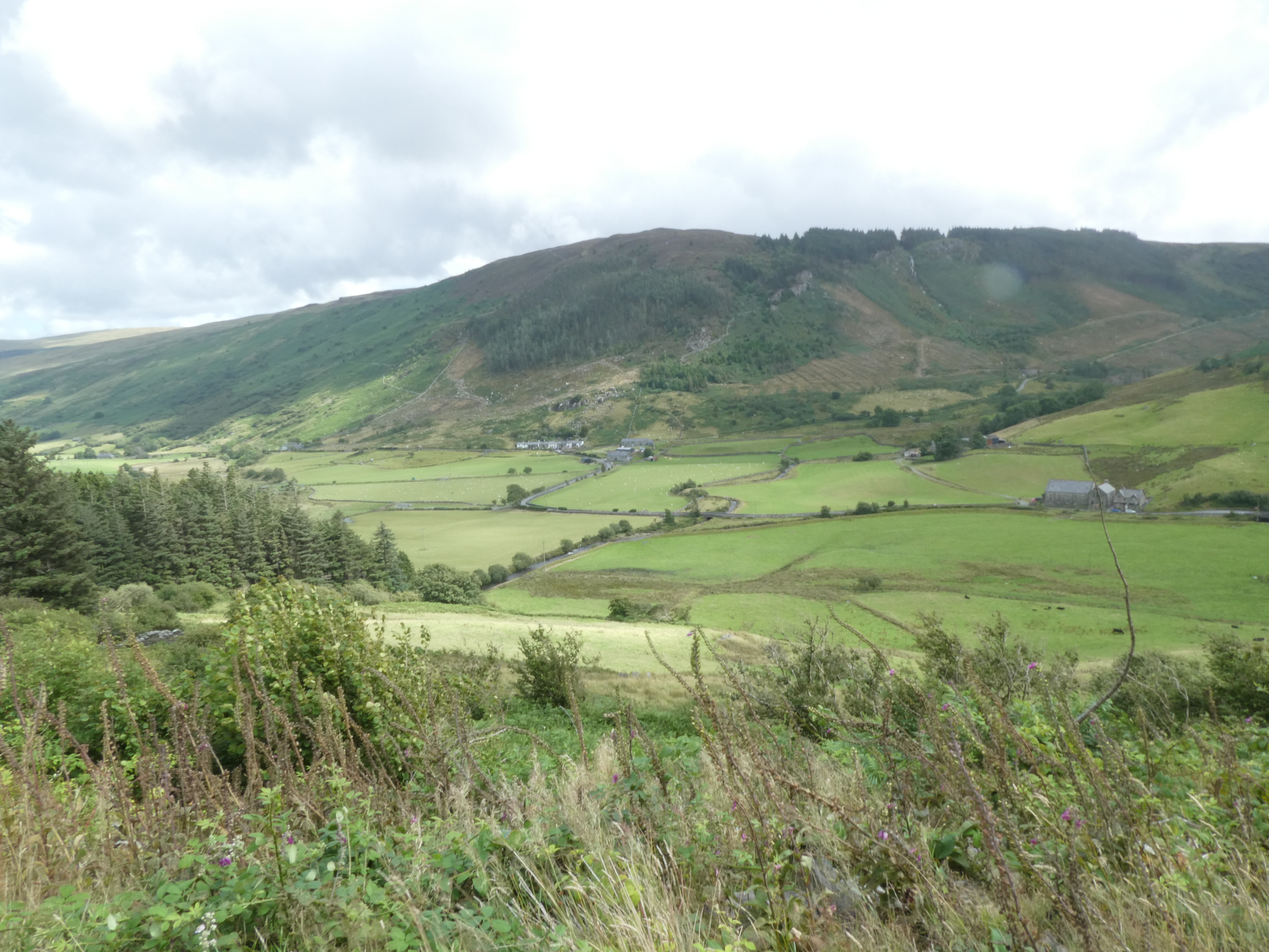
We kept descending down slate chip covered trail to get to a charming little valley, with just four or five miles to go.
And just to tease us one last time, after a nice little section of perhaps a quarter mile of road walking through the tiny village of Cwm Penmachno at the bottom of the valley, the trail veered off up a hillside through ferns cleverly placed right on the uphill side of a fence, so you couldn’t even try to find an alternative path without climbing up higher through ferns. Then the trail relented and offered us an easy forestry road to follow for a long way until descending at last to Penmachno. There are no B&Bs or hotels in Penmachno, so the hike included scheduling a taxi to come pick us up and take us to the hopping town of Betws Y Coed for the night. But with the dire warningsof the guide and website in mind about how long and hard the day was, we’d left a lot of time, scheduling our ride for 5pm. We arrived in Penmachno at 3:30, and there was no cell service, so we were just going to have to wait. Fortunately, the town does have a little store, so we enjoyed a cold drink and took off our boots and socks to air our feet.
Also fortunate was the fact that the Eagles bunkhouse, our pickup site, was also where a group of workers had decided to park their van, smoke, chat, play their radio loud and kill some time, about ten feet away from the bench we had laid claim to. At first this was kind of annoying, especially since several of them smoked, but after a while we realized that this was a good distraction. We even discreetly sang along a bit when they played, in weird intermittent spurts, Keyy Rogers’ “The Gambler.” You got to know when to hold ’em, know when to fold ’em, know when to walk away, know when to run. THough with our boots and socks off, I don’t think we were going to be doing any running.
When you have an hour and a half to kill, workers screwing around and shooting the shit and stalling until the workday is over make for good entertainment.
Tomorrow, 11.5 miles. Of the first 5.3 miles, the website reassuringly remarks “After the last leg, this section is a doddle.” I’m suspicious that this is understatement, and assume there will be ferns and wet bits, but these last two days promise a bit less demanding, as long as the weather holds. Whatever comes, you have to hike your hike. And know when to run. Or something like that.

Boggy moors of the Migneint could be the name of your memoir.
I would also make a good album title…
Wow what a day!! From an observer’s perspective, it seemed to have so many attractions. The waterfalls were outstanding! What a treat! And some of the vistas as well as the surprises were intriguing! And such a cute photo with the pony! And singing with the work crew – I can hear the Gambler loud and clear! Thanks for sharing all these wonderful things. Looking forward to tomorrow! Hike your hike!! 👍😁
Fabulous pics!