Monday, July 1: Skipton to Malham
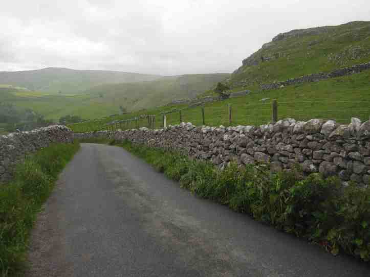
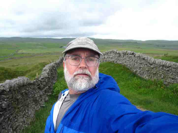
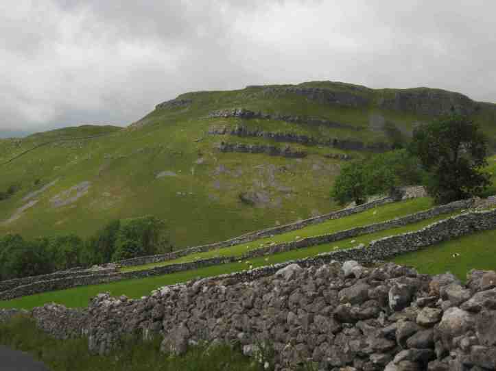
The town of Skipton is set in a valley, and the hills are big, but still have a gentle pastoral beauty. But I know that the Yorkshire Dales, on the southern edge of which the town sits, have big rough open expanses. This walk involves long climbs. These aren’t the short bursts of up and down we groaned about on the Hadrian’s Wall Path. These are hills that climb and climb. You can walk for forty minutes going steadily up, thinking ‘I see where the top is,’ then reach that point only to learn it isn’t the top at all; the top was concealed by the rise of the hill, and you still have another stretch of relentless up. But the views and the incredible geological wonders are worth it. Here’s a teaser photo from late in the day:
The day started with bleak weather. Though the forecast called for morning showers lasting just a few hours and then afternoon clearing, I know better than to trust the forecasts. Sometimes a forecast like that can mean light drizzle all day, sometimes it can mean soaking rain and high winds.
So after a light breakfast (my hostess seemed half-jokingly taken aback at my declining any cooked breakfast in favor of just cereal and yogurt), I put on my rain jacket and set out in the cool, wet morning.
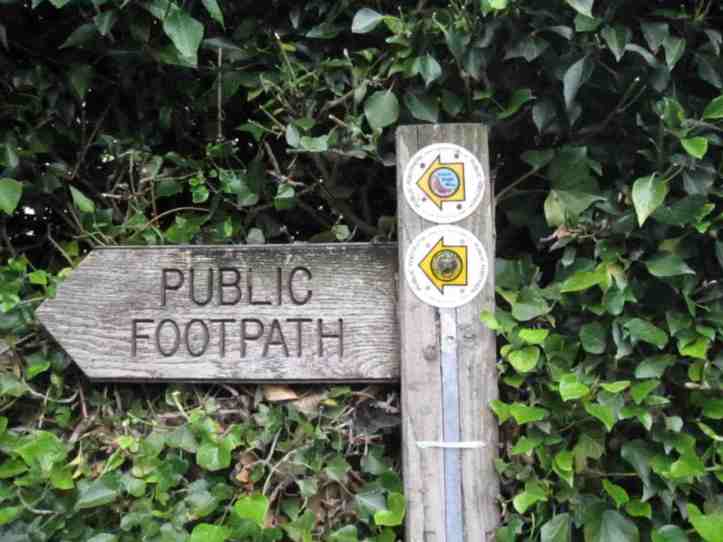
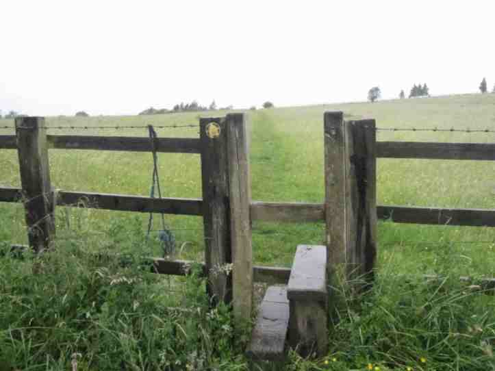
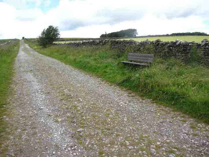
The trail leaves Skipton up a side street that soon lets into a field, and immediately I was reminded that every trail has its own character when it comes to signage and clarity of the way. Hadrian’s Wall is clear and well-marked and there were only a few places in seven days where we had any doubts about which way to go. On this first day of the Dales High Way, I missed a turn within the first 500 yards of the trail, and though I eventually got back on the trail by a bit of map reading after realizing my error, it was just the first of several genuine head-scratching moments on the trail in which I peered at the map, looked at the landscape ahead, looked back at the map, checked some prominent feature, stared some more and then shrugged and went down the trail that went, say, a bit more left than right.
So this was a day all about testing my tough walker spirit (it did in fact rain all morning, and at times it was just pouring, so that my boots were soaked through within half an hour of starting) and reminding me that I actually know how to tackle a more challenging trail. I am not going to venture off on some off-trail adventure, and I wouldn’t lay money on my chances if dropped in the wilderness, but I can read a topographical map and I know how to read the signs in a big open landscape to see that that area with slightly flattened grass is the trail.
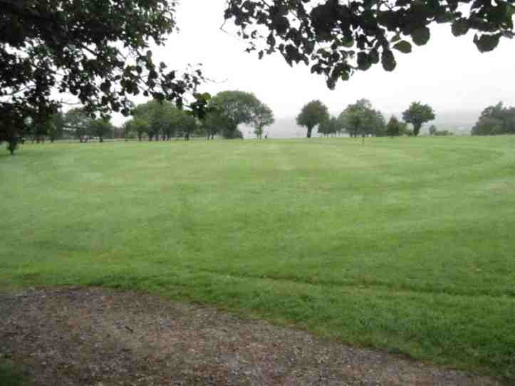
Along the way, after I’d done my little half-mile detour (all I can say is that those cows must have been puzzled to see me walk past, reach a stone wall with no gate or stile, then turn around and walk past them again…), and after I’d crossed a golf course…
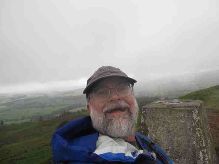
I met a nice couple also walking my way, and for a mile or so we walked together and chatted. She was recovering from knee replacement surgery done in late fall, and this was her first big walk since the slow recovery process. We chatted about trails, and they recommended I join the Long Distance Walkers Association, a British club for trail nuts. Hmm. They were doing a ‘short’ eight mile walk up to Sharp Haw, a dramatic high point with a trig point (cement markers used for triangulation in surveying– you find them at the top of things all over the UK) and then back down around to the canal walk back into Skipton, where she lives. He’s from somewhere else, and I didn’t quite work out the relationship- dating? Brother and sister? Walking friends? Anyway, they were nice to chat with in the drizzle that was gradually getting worse.
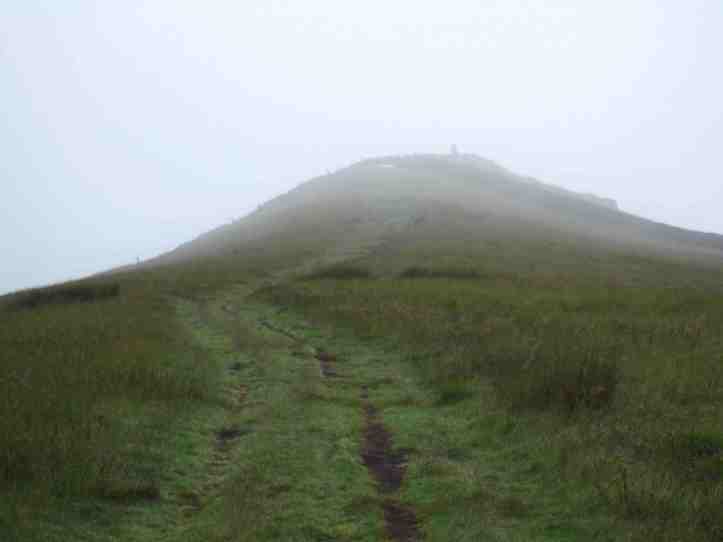
As we rose toward the high trig point at Sharp Haw, they slowed a bit, and with a cheerful goodbye and good luck we parted ways. Sharp Haw is at 357 meters above sea level, Skipton Castle, where I basically started my day, is at 140 meters. And in the last kilometer up to Sharp Haw, you gain 100 of those meters. Woof. But the views. Of course, the trail down is a bit hard to find, but oh well. I’ve got the competence to do it.
I should note that I hadn’t seen a trail mark in perhaps half a mile. That may not seem like a lot, but it was just the beginning of this trail’s more casual approach to waymarking. The Dales High Way has an air of indifference to the walker. It assume you know the way, or have a good map, or both. It throws the occasional trail marker at you, not for reassurance at a confusing junction, but just sort of like an inside joke between friends. “Hey,” it says with a trail sign on a gate after fifteen gates with no marking, “remember that thing about this being ‘the Dales High Way’? Isn’t that fun? Aren’t we sharing a laugh?” Then on it goes.
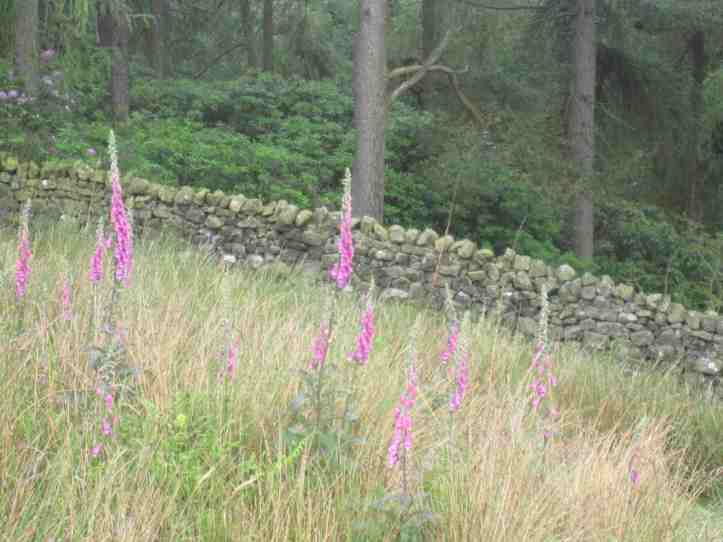
The descent took me down through a very cow-pocked set of fields (both deep hoofprints in the mucky wet soil and other more obvious marks of cows passing by, if you catch my drift), with a steep set of paths–at one point I could see four different paths ahead all leading roughly to the same bottom edge–and lovely patches of my old friend foxglove.
Eventually, having dropped back down to about 170 meters (I love checking all this in retrospect on the Ordnance Survey Map– at the time it was just ‘having dropped a long damn way down’), I had one of those ‘am I sure?’ moments about the trail. The cattle seemed as doubtful of me as I was of the idea that this was the right trail, but I forged ahead, and they gave way.

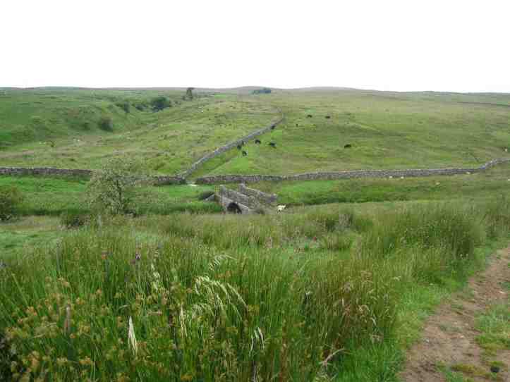
The trail finally crosses a farm and eases down to a river bank, then turns and rises north toward the village of Hetton. In this stretch, the rain hit downpour for about ten minutes, and I was starting to feel a bit grumbly about the whole thing.

After a mile and a half or so, in dramatically lessening rain, I reached the little town of Hetton. Hetton had no shops I could see, but I did pass a pub, the Angel, and thought the sign looked a bit more posh than the usual. I learned on the next day’s hike, when chatting with another walker about our various observations, that this pub is featured in the fancy-eating-and-chatting TV series (and later, film) The Trip. So we can chalk up another skill for me: the ability to identify expensive Michelin-starred pubs just by the tasteful lettering of their signs.
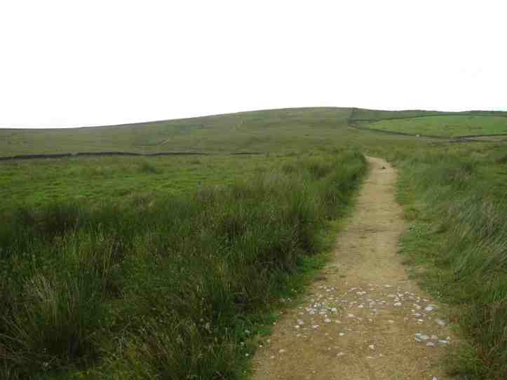
The trail turned up a long, long dirt road with stone fences on both sides, and then later on field paths, rising for the next three miles to Weets Top, at 414 meters. This climb had less rain, but now the winds whipped up to, I’d guess, 25 miles an hour. That’s serious wind when you are walking over open ground in wet clothes in temperatures in the high 50s. But the drama of the landscape made it worth it.
The trail now did some serious descending, quickly turning onto a road, with, I am thrilled to report, a trail marker indicating that I was still on the trail!
The road plunged. Descended isn’t strong enough. It plunged down a hill, shedding a few hundred meters in about a quarter of a mile. The knees know what’s up, and they tell the brain in no uncertain terms. And of course on a paved road, the walking poles are less helpful at easing the impact. Oh my cartilage.
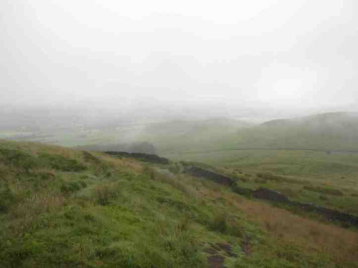
But the trail has now come to a dramatic (I have to find a new word) shift in the landscape. A prehistoric heaving forced some of the ground along a faultline in the Dales up, while the land to the south went down, forming a lone line of cliffs and changing the whole geology of the area. I’ll be dealing with that faultline for the rest of this day (not much left, having busted my butt for ten miles already) and all of tomorrow’s walk.
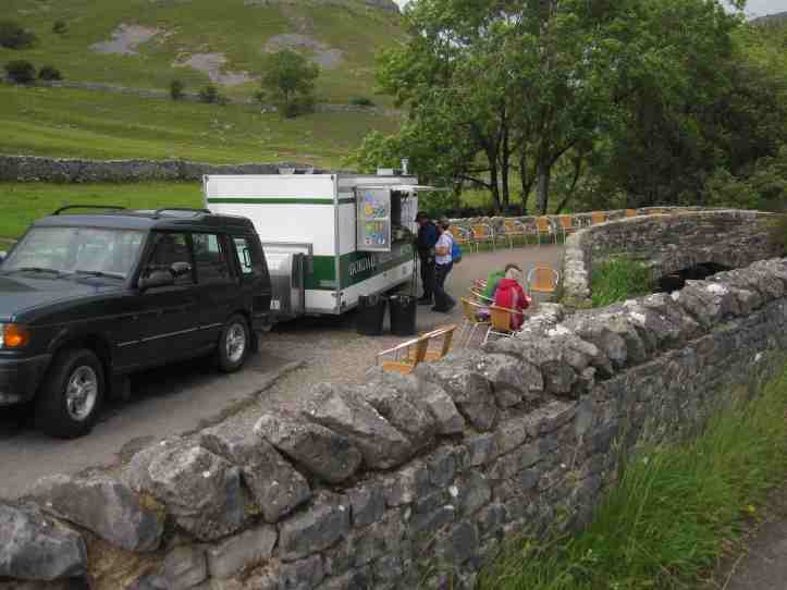
At the bottom of this hill, where I knew I was turning off the trail to reach my accommodation in the town of Malham, I found an unexpected few dozen people out doing what I assume, based on their lack of gear, were day walks. And a snack truck. Reader, you will be stunned to learn I did not stop to get a Diet Coke. (The fact that I had Diet Coke in my vacuum thermos and had drunk it with the chocolate bar just fifteen minutes earlier may have had something to do with this)
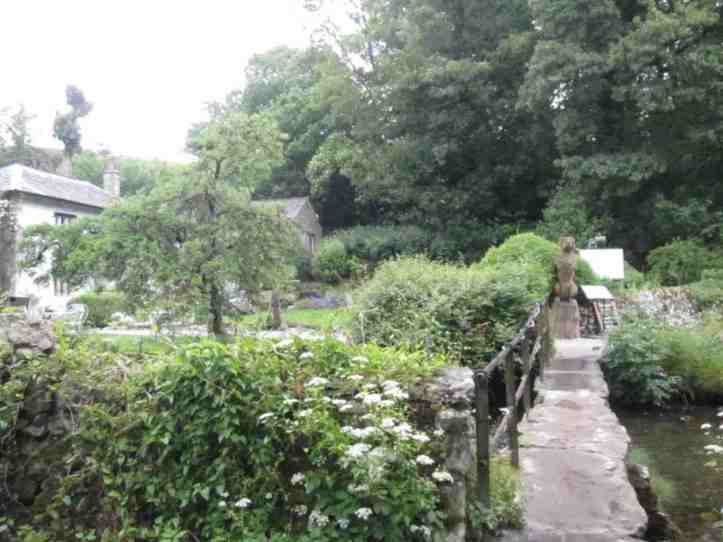
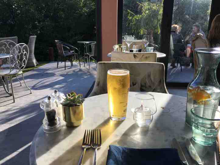
After a lovely walk through a wood by a waterfall, Janet’s Foss, and passing a surprising number of walkers–perhaps a dozen in half a mile after seeing no one for three hours and six and a half miles–I came to the town of Malham. Here I realized that Malham is the sort of little town people come to if they want to do day walks. There are amazing places like Malham Cove to visit (more about that in tomorrow’s walk, when I encounter it almost first thing) and Janet’s Foss, and the big line of hills with exposed limestone give the whole area drama. I ended my hike at Malham’s Beck Hall, a hotel with very fancy food, a little stream running alongside the patio, and a dog-friendly policy that means there were dogs in the dining room at dinner, sitting calmly under their masters’ tables.
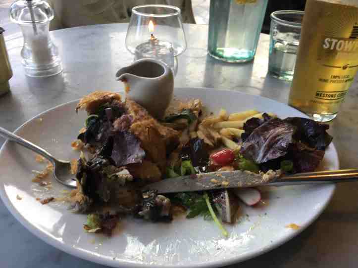
I finished the day with a delicious meal of spinach, pine nut and mushroom wellington, eaten at a table by the foldaway glass doors opened, the better to hear the babbling brook and breath the country air, with anodyne piano music piped in at a discreet volume to complete the sophisticated ambiance. After a wet day on high dales in rain and wind, I felt like I’d earned it by demonstrating my trail competence all day.

Sounds like a great day Hank, despite the rain. Enjoy!
[…] walk started and ended with bits of walking I have done before. The first mile and a half or so I did as part of the Dales High Way back in 2019, and the last two and a half or so was along the River Wharfe, which I walked just a few days ago […]