The last day on a walking trail is a tricky business. Some end with obvious drama and a clear exclamation point. Offa’s Dyke Trail winds down into the seaside town of Prestatyn, and after some culture shock navigating a beach vacation destination (several ice cream shops little crafts stores, people wandering around trying to figure out what they should do now that they’ve seen the shore and eaten ice cream), there is a thrilling ending with a statue that, for those who have come all the way up the Welsh border, says “You did it.” The Cotswold Way winds down over rolling hills into Bath, with breathtaking new revelations of the city you are approaching at each new bend in the trail. Yes, the entry in to the city is a maze of cuts through alleys and across school playgrounds, but you arrive at the famed Roman baths to finish the walk. The Two Moors Way in Devon drops down from a huge elevation to the shore at Lynmouth in an excruciating but exhilarating few miles of knee-testing descent toward the Bristol Channel, but you can see Lynton and Lynmouth, the funny little twin towns, nestled into the coast like something out of a storybook version of seaport life (think Robert Altman’s crazy set for the movie Popeye…). Imagine more touristy stuff, but with the smug satisfaction of knowing that your sweatiness and backpack and walking sticks set you aside from these people who arrived in cars, for heavens sake. The South Downs Way ends in the bigger seaside city of Eastbourne, but you can forgive its pier adapted into a shopping mall and rows of seaside hotels, because you have spent the last day of that trail walking the Seven Sisters, a stunning geological fireworks show of cliffs (think White Cliffs of Dover, and you’re walking along the cliff for hours and hours) that is a thrilling third act plot twist on a trail that has been all about the high rolling downs from the start, with nary a thought until the last day of the English Channel views that provide the climax.
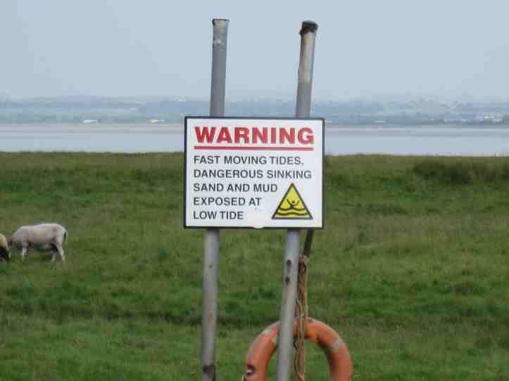
The Hadrian’s Wall Path ends with fourteen miles of various degrees of flat. There are certainly small ups and downs, sets of stone stairs as you rise and fall to follow the River Eden as it makes its way into the Solway Firth and so out to the Irish Sea. The drama is provided by the landscape. It’s lovely, of course, and it is fascinating to walk across a long salt marsh that floods at very high tides.
But for the most part, the drama of the day is internal. The triumphant feeling comes more from the sense of accomplishment. That’s fine. We accomplished a lot. And of course we had our dramatic last-act twist with the Return of Rob, newly energized and at least healed up enough on the blistered sole front to make the final leg of the journey with us.
The day began in Carlisle, and as often happens on footpaths in cities, there were a few hesitations finding the trail. But once we were on it, we were like arrows loosed from the bow. The path follows the River Eden, sometimes closely and sometimes at enough of a distance that you are only vaguely aware of it as an abstraction somewhere off to the right.
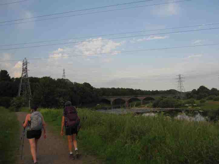
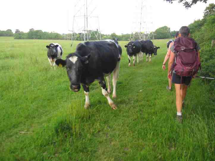
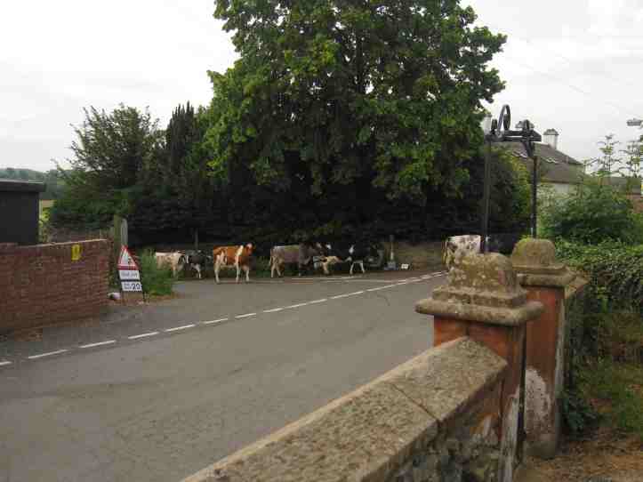
As the morning wore on, it got warmer, and we were definitely feeling the difference between the cool windy hills of the central part of this trail and this warmer, less breezy day. It was only in the mid-70s, I’d guess, but if you are hiking 14 miles with even a light pack, the difference between 60 or 65 degrees and 75 degrees is huge. Having been fairly relentless walkers for most of the path, today we remembered the value of taking breaks. Partly, of course, this was because we wanted to make sure Rob could keep up, or sometimes catch up. But it worked out well. Take the pause on the lawn of a church, which turned out to have been built on the site of a Roman milecastle, perhaps the last Roman-themed thing we’d see on this last day. And while we paused there, we saw a herd of cows just casually making their way up the road.
And then we hit the salt flats. Technically, this is along the line of the wall, but you can’t really tell, since what you are seeing is mostly just big flat areas with an odd bit of high ground that could be Roman or could be as recent as mid-20th Century. At this point in the trail, to be honest, we weren’t caring much anymore about vallum-spotting and other Roman archaeological arcana.


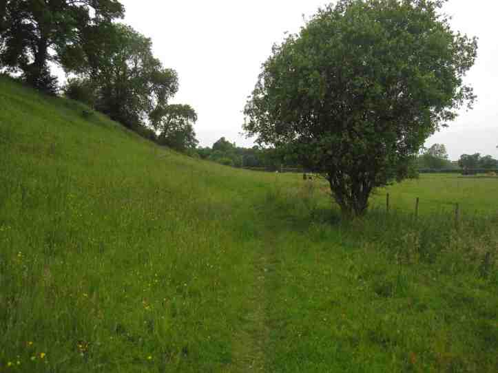
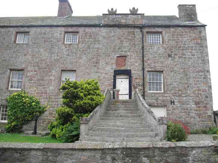
After several long miles on the flats, we came to a rise on the land at Drumburgh, which boasts a house that is labelled as a castle, which in this context just means a house with the entry above ground level for defensive purposes.
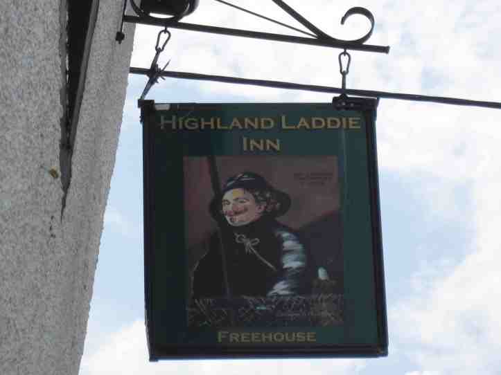
A bit of internet research suggested that if we could keep slogging for a few more kilometers, we’d find a pub at the tiny town of Glasson. By this point, Rob’s pace was slowing as he managed ways to avoid aggravating the blister on his foot, so the pub and the prospect was dangled like a carrot. But honestly, it was a carrot for all of us.
And then we got to the Highland Laddie Inn, destroyer of dreams, crusher of hopes. Closed, and property for sale.
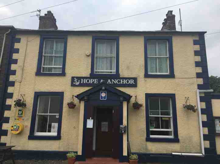
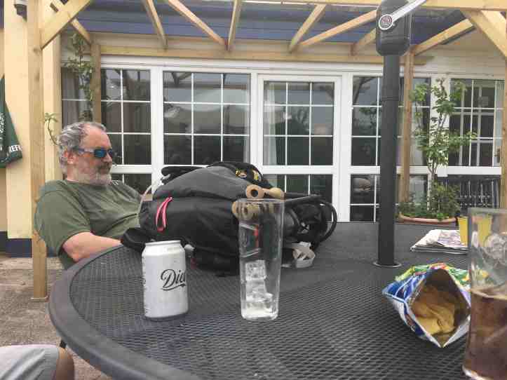
Another quick bit of internet sleuthing suggested that, no seriously, in Port Carlisle there would be a pub. It was marked as open today in Google. Trust Google (which had not indicated anything about opening hours for the Highland Laddie, the Brigadoon of pubs).
So we forged ahead. And just look at the blissed out travelers, enjoying soda and packets of crisps.

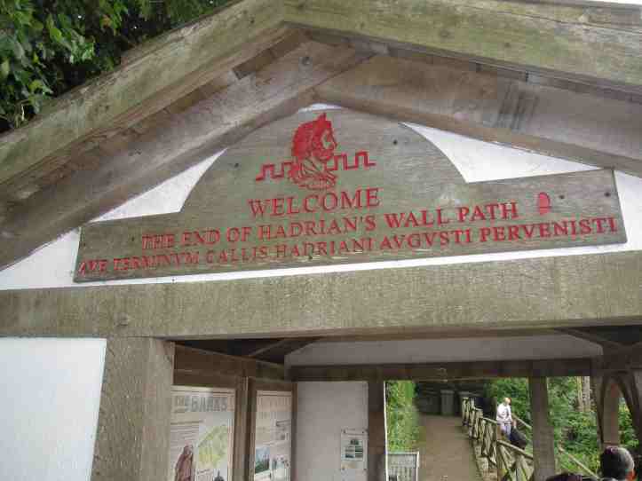
From this point on, with just 2.3 miles left (I got that exact number later from research- at the time we just estimated it as a few more miles), we were all about the finish line. Get across the line, get to Bowness-on-Solway, get a photo in our Sartin walk shirts, check into our B&B, shower.
Readers, we made it. Our B&B was, alas, very strict about the check-in time. No one was there, so we had to kill time in Bowness-on Solway, which is a bit of a trick, given that there is one pub and one little village shoplet and the little hut at the end of the trail. So there was a bit of sitting around patting ourselves on the back (given the general stiffness, the back-patting was purely metaphorical).
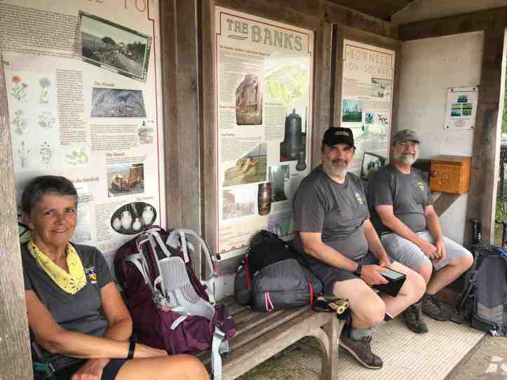
And my camera, in a fit of rebellion, decided this was the right moment to have a fit of heat exhaustion or battery rejection or something, so I couldn’t get it to work long enough to set it up on the gorilla-pod tripod and photograph all four of us. Karen got a few good selfies of the four of us, but in all the excitement of the day and the next morning, when we all parted ways, I got some of her photos, but somehow not the good selfies. So this photo of three out of four will have to do.
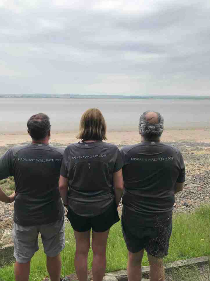
For me, there are four days of walking in the Yorkshire Dales ahead. For everyone else, the paths lead elsewhere. But what an adventure we shared.

What an adventure indeed! Kudos to all intrepid Sartins👏
Sent from my iPhone
>