In telecommunications, transportation and delivery, there’s something known as the “last mile” problem. (stick with me for a bit here, I promise this will get to walking.) Simply put, the cost of getting goods and services to people shoots way up in the last mile to delivery. There are cost efficiencies of scale in getting items shipped broadly from, say, California to Illinois. And if you have a warehouse in California, your shipping costs are low at the start because you are doing bulk shipping from the same place. But once my new kitchen knife makes it to a Chicago sorting center, the cost associated with getting it in my hands goes up. More labor goes into sorting and getting it on a truck and to my apartment than has gone into getting it from the California warehouse to Chicago. Similarly, in telecom, economies of scale make high speed cable, for instance, less expensive to lay over large distances. But especially in established communities, getting fiber-optic or whatever into homes means digging up streets and wiring individual buildings.
When doing a long walk, there’s a somewhat related last mile problem at the scale of each day and the overall journey. After a long day of walking, no matter whether that means nine miles or seventeen, the last mile has a special quality of both anticipation, energizing you with the prospect of the end, but also exhaustion. That last mile costs more emotionally and physically, somehow. Particularly if you don’t know the ground you are walking, time and space start to slow and expand. Since you don’t know whether the town is around that next corner or another three turnings of the road, each step feels like it ought to be your last, and then frustratingly isn’t. On all the walks I’ve taken in the U.K., this is exacerbated by the fact that practically all towns lie either at the crest of a hill or in the depths of a valley. So each day, my knees are protesting the steep downhill into town, or my thighs are protesting the steep up. The human expenditure in that last mile feels far greater simply because you know it’s that last mile.
And the final day or two of a long walk, similarly, has a charged, electric quality combined with weary muscles that makes it feel different, like a whole different kind of expenditure of energy, than what has come before. I’ve written on a previous walk about a related feeling, the drumbeat of completion. (Wow, now I’m citing myself. Gosh, I’ve written a lot about walking.) On this walk, the last day is especially dramatic, because it’s seventeen miles after a fourteen mile day. That may not sound like a lot if you’re driving, but three extra miles of walking at the end of 200+ miles really does add something. And all day I found myself thinking “I’m that much closer to the finish…,” “Another half mile closer…” and on and on.
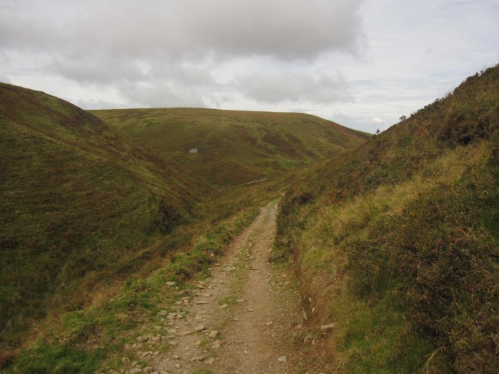
The day began with a rapid rise (I love how that makes it sound like I was a bread loaf in the making, but one that gasped and groaned) out of Withypool up onto the moors. The first six miles of the day were a lovely journey over empty rounded moor hills, but on mostly fairly easy to find path with less than the usual amount of mud walking, sometimes descending to come near the banks of the River Barle, in beautiful wooded valleys. I saw no one for the two and a half hours of walking, and just enjoyed the cool air and clear-ish skies (no rain forecast for today). This part of the trail also has an interesting history that is clearly indicated by the trees. Much of the land was purchased and turned into the Royal Forest of Exmoor, with ‘forest’ in this case really meaning ‘hunting area,’ which was marked off in the 13th Century. In the early 19th Century, wealthy industrialist John Knight bought 10,000 acres of the Royal Forest and made ‘improvements,’ some of which were efforts at establishing mining. But he clearly also planted trees, because often in the morning I saw organized lines of trees that clearly were planted to make for a lovely path to ride or walk. I also, alas, saw whole hillsides that had been cleared of trees, in one case within the last few years.
The path passes through the small village of Simonsbath, and then, as the guide cheerfully notes, hits one of those challenging bits of unmarked path that challenge the navigation. After rising out of the valley in which Simonsbath is nestled, the path climbs over The Chains, “Exmoor’s highest and remotest ground.” To get to Exe Head, the origins of the Exe River, the path, after crossing a road, goes into a huge farm field on a domed hill.

The trouble is that you can’t see over the dome, and there is no one path through this open expanse where sheep graze and wander. So I had to resort to a combination of close reading of the guide description and compass, and I still ended up plodding through a stretch of boggy high rush, sometimes plunging into watery bits up to my ankles. Here’s the guide:
Turn left along the hedgebank to reach a path junction. Although Exe Head is signed straight ahead the line of the path bears half-right (northwest)across Dure Down, aiming for the far corner, interspersed with clumps of woody rush (in places quite dense). Try not to stray too far to the right. Eventually a wire fence running along the Chains path appears away to the right; this path is met at Exe Head at a bridlepath junction, also marking the watershed. Cross over and pass through the gate, signed to Hoar Oak.
Right. Got it. This huge domelike field, in which I cannot see the far side, has a ‘path’ (no it doesn’t) and eventually I’ll spot a wire fence. But I have to be careful not to go too far to the right. (Why? Will I miss the fence and wander the Dure Down forever?). So, of course, I started out northwest by the compass, but then over-compensated to the left, more like west by northwest, and when I spotted a fence running north-south, with what looked like a gate at the far north end in a corner, with stone wall to the west and, I thought I could see, wire fence going east, I aimed for the gate. That led me into those woody rushes, with absolutely no sign of a path at all.
And when I go to that corner of fence, where the wire fence came up from the south and then turned off to the east, there was indeed a set of signs. But it said that to the west the path was to “Pinkworthy Pond” and had a sign pointing east along the fence to “Exe Head.” Neither had a Two Moors Way mark. I broke out the map and puzzled over this. To the east was a clear path down and up the rolling side of Dure Down. I decided to walk that way, though I couldn’t see any junction or gate. Sure enough, after about forty yards, I passed over a small crest and in a dip in the hill, saw a gate with a signpost, clearly Exe Head. And just as I spotted it, looking back to the southeast, I saw three people walking much as I had, overshooting to the west, about five hundred yards back, clearly heading into that same boggy area of rushes I had just sloshed through. I tried to wave them over to the west, then headed on. They’d work it out, and I had ten more miles to go today. The punchline, from further studying my map, is that if, after crossing the road, instead of going into the farmer’s field and up over Dure Down, I’d stayed on the road for about 200 yards, I’d have come to the Tarka Trail, which is the clear path without rushes coming from the east to Exe Head and on over to the gate leading to Pinkworthy Pond.
In retrospect, I know, this story sounds like a rousing example of my trail-finding skills, even when I go a bit wrong. But while it happens, it’s always a bit unnerving to be walking through boggy rushes and not have any visible path behind or ahead and be aiming vaguely toward something you think might be the right landmark. I love having done it, but less so during the doing.

Then the path is very easy to follow, winding down steadily in the winding valley carved by the Exe. Down and down it went, with my right knee making obscene remarks every so often. Well, someone was making obscene remarks, and my knee was certainly a likely candidate. Because I have been favoring my left ankle, the one I twisted lo those many days ago, I have developed a compensatory soreness in my right knee, which has been taking more stress than my left on downhills. A few times, I glanced back and was able to see in the far distance behind me that the three hikers I’d seen heading into the bog had made it out and were still behind me. I figured that they’d overtake me at some point, given my slow pace on downhills. But the next thing I knew, I had crossed and recrossed the Exe (once fording it on rocks, once on a little bridge), and was rising again onto high moor.
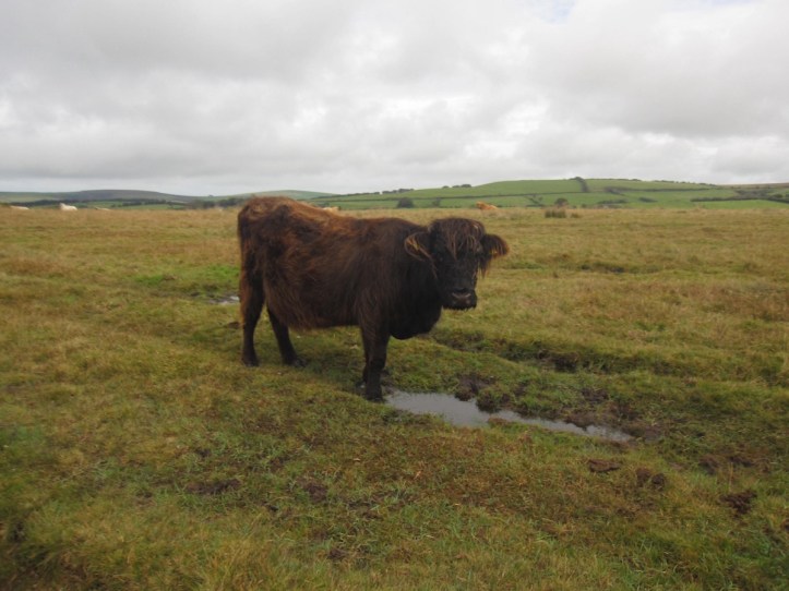
There’s a nice few miles of simple mindless walking on the high moor on a clear path, until I found myself in a field of the shaggiest cattle I’ve seen, all giving me a suspicious look, as if to ask whether I am a vegetarian. A quick pass through the farmyard took me briefly onto paved road, and then down down down a very steep path of large rocks and scree, tricky going.
In a quiet glade by a riverside, I sat and ate a Clif bar and rested my knee, and finally the three walkers caught up with me. Turned out to be three men I had seen yesterday on the high hill on my way into Withypool, where I’d been so disappointed at not seeing ponies. On that occasion, as they were going up and I was going down into Withypool, one had said “You’re going the right way–down.” To which I replied as I hobbled by on a knee quite achy by that point in the day, “Don’t tell me knee.” Today, recognizing me, they very kindly stopped and asked, if a bit too solicitously, if I was alright, and asked if my knees were alright. I explained my whole twisted ankle 200 miles of walking riff and sent them on ahead, figuring I’d never see them again. Hah. I saw them three more times later in the afternoon. They’d stop to rest and chat and whatever, I’d walk past and say hello again and make some sort of joke (“It’s a game of leapfrog all the way to Lynmouth”) and then they’d pass me a bit later. What I’d stress is just how nice people are to each other on the walking paths. Walkers sympathize if you are sore, walkers know what it means to be out for more than a day hike (You can usually tell by the packs and the walking poles, though many day hikers will have one or two walking poles and sometimes packs–still you can tell the difference). Walkers make jokes about the pub at the end of the trail. It’s a wonderful thing.
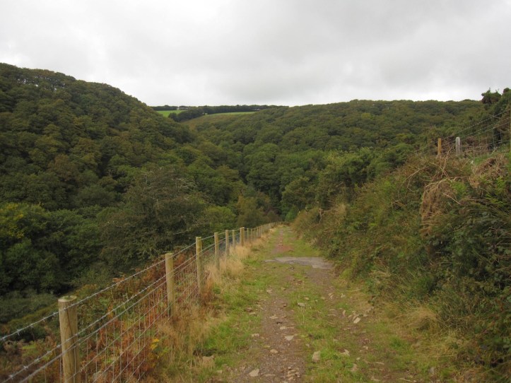
The last mile into Lynmouth really is a problem, simply because of elevation change. In two miles you go from 350 meters above sea level down to about 80 meters above, then up to about 175, then down and down and down into Lynmouth. In the last quarter mile,
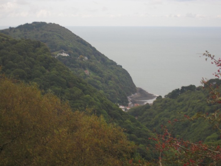
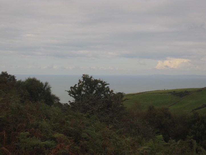
I passed two older couples (mid-sixties, I’d guess) who had clearly walked up from Lynmouth and were now headed back down this steep and often slippery and muddy and stone-strewn path. One of them stopped and took up a fallen branch as a walking stick, and another said this was the hardest walk he’d ever taken. Inside I smiled a wry smile, thinking about what I was finishing. But I didn’t say anything like “yeah, I just walked over 200 miles with rain and a fall and enough elevation change to prep me for a trek in the Andes.” Instead I cheered them on, noting by pointing down the switchbacking path “Look how close we are! Almost there now!” Then I set out ahead and made my way into Lynmouth, a touristy seaside fishing town now dominated by souvenir shops and art galleries. And above it, perched in the hill above, is Lynton, where my B&B for the night is. The good news, the very good news indeed, is that there is a wonderful funicular railway that takes you up the cliff rising 500 feet in elevation while you sit in a little railcar with a dozen or so other people, hoping they can’t smell how ripe you are from sweat and whatever is on your boots.

It was a fantastic finish to a demanding walk. I’ve seen far more rain on this trip than on my past three trips combined. I’ve suffered an injury. I’ve recovered. I’ve mapped my way out of a few iffy bits. I’ve sung snippets of Peter Paul and Mary, Sinatra and Broadway showtunes all with alarming abandon while puzzled and nervous sheep and cows looked at me like I was nuts. I’ve mused on time and distance and memory and meditation. I’ve had a wonderful chance to take a breather from my normal life.
And what next? So many trails still out there. I’ve been thinking this trip, as I do each time, about what features I like in a walk. This one had good natural challenges, but was a bit short on castles, which I find a nice diversion. (Yes, a good historic iron-age burial mound is interesting, but it’s really fun in the middle of a walking day to tour a castle with a bunch of tourists who are vaguely annoyed by your pack with walking poles strapped to it). And I think perhaps I’d like to have a portion of my next walk be a bit flatter, maybe a good long stretch of river walking thrown in with the usual ups and downs (that was one pleasant thing about the Shakespeare Way–some nice long stretches on rivers and canals). There are some very tempting trails in Wales. And I’ve heard from my friends Sharon and John that Scotland’s West Highland Way is good. And there’s always a return to Ireland. Or heck, I could go to France or Spain or Norway. Or maybe next year, just for variety’s sake, I’ll go lie on a beach. Until then, thanks for sharing my way with me.

Congratulations!
Another super achievement – well done Hank!
Excellent! Time for another hike for me if you’d like company.
Congratulations Hank!! Seemed like a wide variety of environments this time! Enjoyed it so much!!