After Monday’s marathon, Tuesday was blessedly a shorter walking day, though we couldn’t get the various sources (the mileage indicated by our travel company, the Cicerone guide to the trail) to agree—either 10 or 13 miles. Further investigation confirms that it is 13, and our Tuesday night B&B hostess affirms that we are not the first customers with Contours to get this specious 10 mile number. She’s actually contacted them and asked them to get it right, apparently to no avail. But either way, it was a shorter day. And we were blessed with some breeze on the high downs.

And having seen how a went through water, I erred on the side of caution and filled my liter bottle of water, my two-liter camelback bag (which fits in my daypack and lets you suck water through a tube like a straw hanging down over your shoulder) and even filled up my small thermos with another half-liter of water. It was still a cloudless day and rose quickly into the 80s, which the wind helped alleviate but didn’t erase. I was still worn down from my march the previous day, so I demanded and got frequent halts all day, sitting down for five minutes something like every hour. But it really helped me. And I guzzled water, going through every last drop I carried before the end of this short day. I think I was still a bit dehydrated from yesterday.

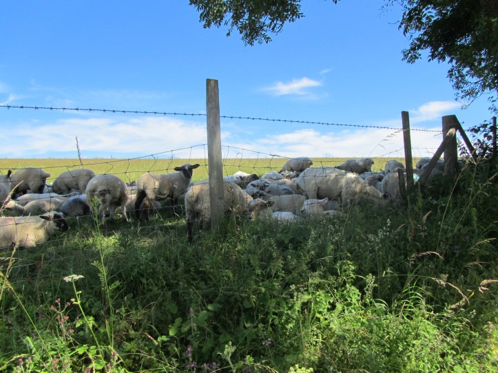
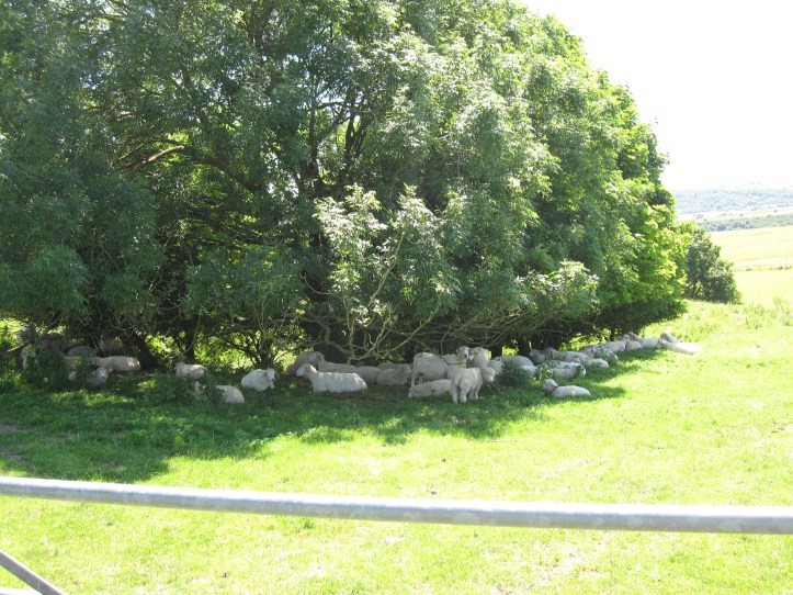
The downs are beautiful, with dramatic views all around. The views today were in fact much better than yesterday, when the longest day was ironically also the one on which you couldn’t get the big sweeping vistas. We passed several really big iron-age hill forts, which I have learned to recognize from all my trips through English countryside. Look for a place at the top of a hill where the land suddenly dips in a ditch and then rises high, and if you get close enough you’ll see that the ditch and the high ground encircle an are in the middle that is lower than the high wall. That’s an iron-age hill fort.
On advice from our lovely B&B hostess Boodie (I just like typing that), we cut off the South Downs Way at a certain point, shifting to the Monarch’s Way to get to our next stop in Upper Beeding more efficiently—with one fewer uphill assaults and cutting off maybe half a mile. The Monarch’s Way plunged down into three little towns so tightly packed together it’s amazing that they retained separate identities: Steyning, Bramber and Upper Beeding. We walked on a sidewalk along a single road that took us on the southern edge of Steyning and Bramber (and past a medieval castle ruin, but we totally missed any sign for where to turn off for it—and I learned later that it is just one standing wall) and into the heart of Upper Beeding, where we settled in at about 3pm and relaxed.
Late in the day, I talked it over with Tracy and decided to take Wednesday off. She wants to walk, so she will do the big 16+ mile walk Wednesday, but I assumed that there would be a way to get to the next stop by bus, and spent our late afternoon downtime sorting out bus schedules. Frankly, I am not a completest—I don’t care if I don’t walk every foot of the trail, and my body tells me that if that 13 miles after 22 miles tired me as it did, I need a day on which my exhausting comes from trying to navigate bus schedule.

As they say: Hike your own hike. Have a good rest and keep having fun.
Ditto what Rob said. And might I add, that is a very handsome cap you are sporting.
Sending cool, calm, restful thoughts. Hoping that invigorates you. Enjoy whatever happens!