The South Downs Way is 100 miles long, and we are walking it in seven days, so you might figure we’d be doing about 15 miles a day, but in fact the way towns are spread out along the path means that day two is the only one that comes in around that average. Today’s hike, with a mile to get back to the trail, was a total of sixteen miles, which is a good long day. Tomorrow we go 21, then a 10 mile, then 19.5, then finish out with two short days, 12 and 11 miles. So we might call today’s hike an average day, but only if you bear in mind it was average only in the way math makes it so.
It was also a day of interesting surprises. We started out walking along the flat way of a former railway line, now a gravel path, to rejoin the trail east of Exton. A horsewoman who passed us wished us a good journey and hoped we were early enough to beat “all those bloody cyclists.” Horse people and walkers, bonded in their mutual annoyance at those fast-moving cyclists.
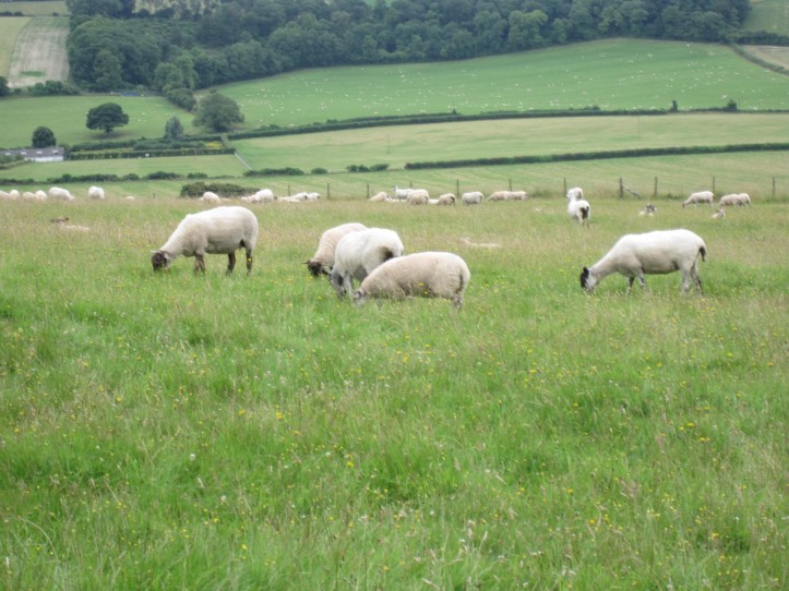
The trail rose high onto the ridge and we saw sheep in big flocks in the high pastures. Through the day we’d note that this trail has more variety than the Shakespeare’s Way in terms of agriculture. We did see a lot of fields of crops, but also a lot more sheep and cattle. Background reading in the trail guide reveals that the South Downs used to have a truly massive number of sheep roaming around, and that the numbers have dwindled in the last half century or so because of lower wool prices.
Along one gentle but long descent, Tracy observed, “Well, this is the un- part, but I think we’ll soon get back to the -dulating. I’m pretty sure the etymology is suspect, but I like the idea that undulating can be broken up into going downhill “un” and going uphill “dulating.” That’s our story and we’re sticking to it. (the subtitle of today’s post is meant as a quote from A Midsummer Night’s Dream, in which Puck, tasked with getting the mixed up lovers sorted out, promises “Up and down, up and down, I will lead them up and down.”
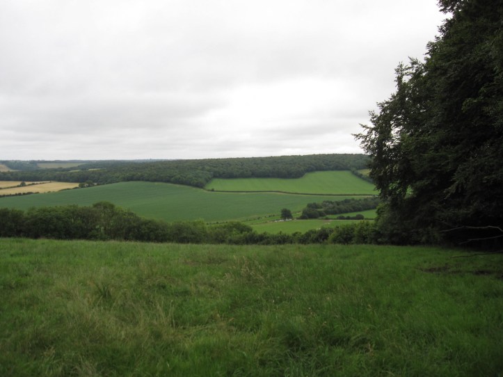
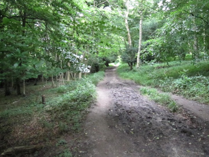
Much of the thrilling landscape here is of the variety that doesn’t really come out in a photograph. The hillside with subtle variations in shades of green, with little valleys and vast distance prospects of more hills, doesn’t have the drama of more rugged landscape, but it’s beautiful in person and makes for walking that is s series of revelations as you come around each bend in the trail or cross over the top of the hill, revealing whole new sets of views.

The first ten miles or so passed pleasantly, but the climax of the day for me was certainly our lunch break at Queen Elizabeth Country Park, where we sat and watched para-gliders circling lazily but dramatically above the high hill.
Miles later, we finally left this large park, which is a “country park,” meaning it feels like a lot of the rest of the landscape only you find parking and picnicking areas down in the bottoms of a few valleys.

At about the twelve mile mark, just when I am getting tired enough to resent any error, we took a wrong turn and had to do a bit of fancy map work to avoid climbing back up a steep hill. Of course, our solution, using a non-South Downs Way path for perhaps a quarter of a mile, involved a brutally steep ascent up a different hill, but we felt very self-satisfied when we regained the SDW and confirmed by passing one of the waymarkers. But that hill had sort of taken it out of me, and I was grateful when, about a mile later, we took a break and sat on green grass outside a lovely farmhouse to sip water and work out our last two miles. Our B&B has a few pigs (“That’s next year’s sausage” as our hostess observed) turkeys, chickens, ducks and a beautiful Weimeraner dog who seems to get along with all the farm animals pretty darn well, perhaps because he can rest in smug superiority because he gets to go inside the house and won’t eventually end up being served at the table. (We hope!)
We had dinner at a pub/restaurant that is the only place in South Harting and has to serve at multiple levels as a business to survive. The restaurant menu is kind of posh (I had smoked salmon ‘cannelloni’ with a watercress panna cotta, which was a pretty little slice of bright green that was sort of like a solidified foam of watercress, and we shared a delicious melted camembert with toast) but they also were doing a big weekend barbecue in the back garden area, so I guess that cheaper option is a way to stay in business.
Tomorrow, the longest day, so we’re going to be careful about taking regular breaks to make sure we don’t get too worn out. There’s plenty of daylight if we need to take it slow, but it looks like there is also a stretch of about six miles in which we walk the ridge and don’t do much un-ning or dulating.
Total walked 15 miles of trail plus one to get back to it, and perhaps .25 for our detour. Let’s call it 16.25 miles.

Carry on😊
Sent from my iPhone
>
Always enjoying the posts! The endurance is so appreciated as I struggle to keep up with the 10-15k on the daily Fitbit as part of regular life. We need another Hank selfie about now! Love to both of you!