We were cautiously bracing for the second day on the Snowdonia Slate Trail. The topographical maps and the guide conveyed that this day would begin with a lot, a lot, a lot of elevation gain as we got up out of the valley where Llanberis is nestled. But we knew it would be only an 8.5-mile day. So the general mentality as we set out was something like “get ready, this first few hours is going to be at a hard incline.”
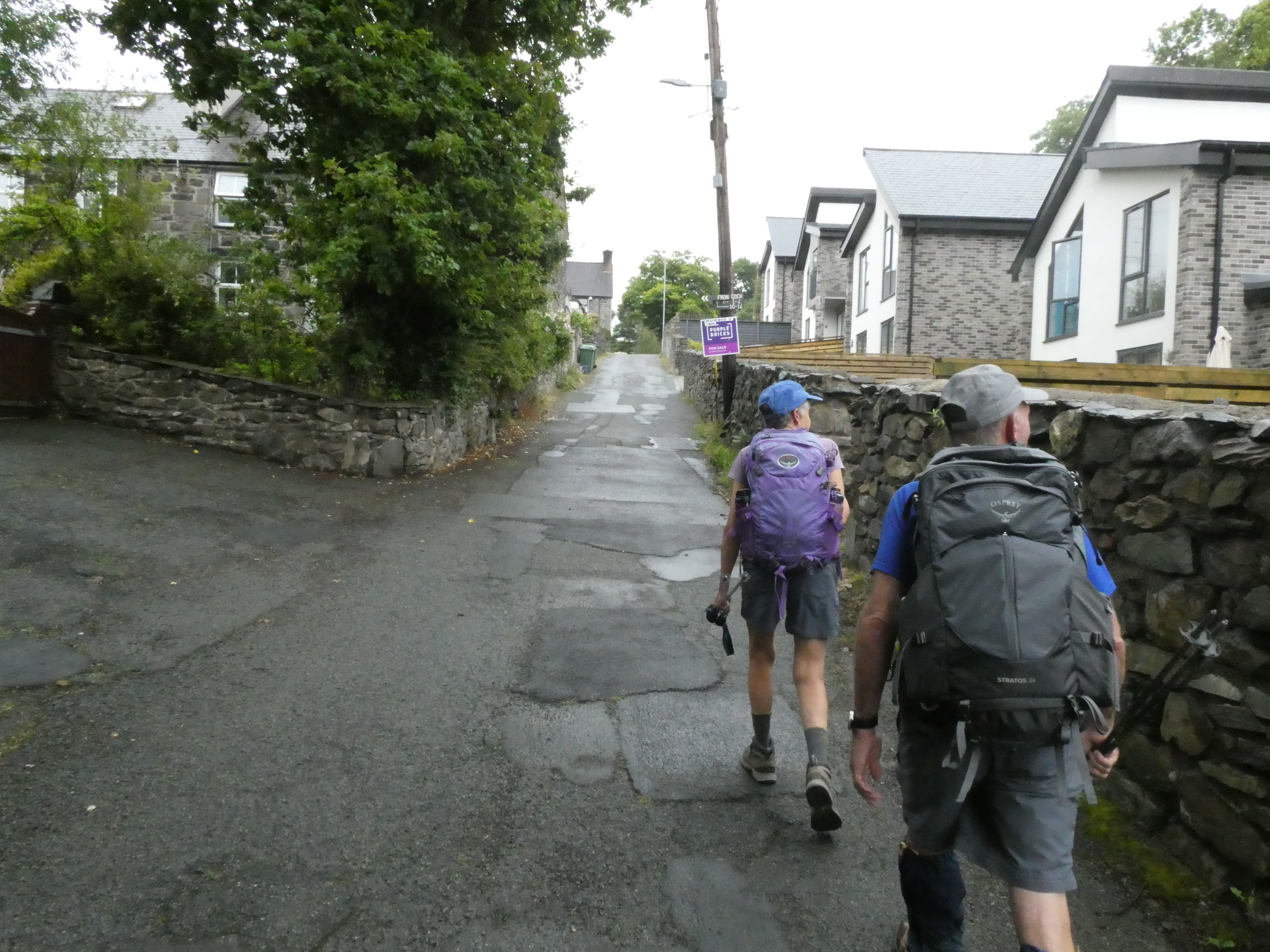
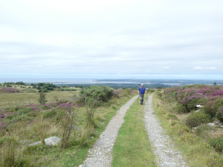
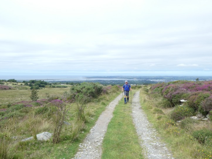
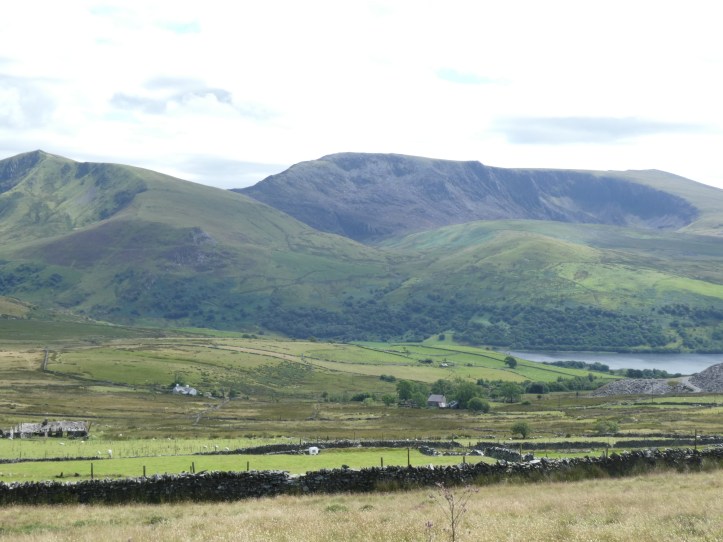
And fair enough, as the above photo suggests, we did a good bit of climbing up increasingly narrow and ragged roads up the hills, until finally leaving roads behind and continuing up over grassy hillsides with breathtaking views in all directions.

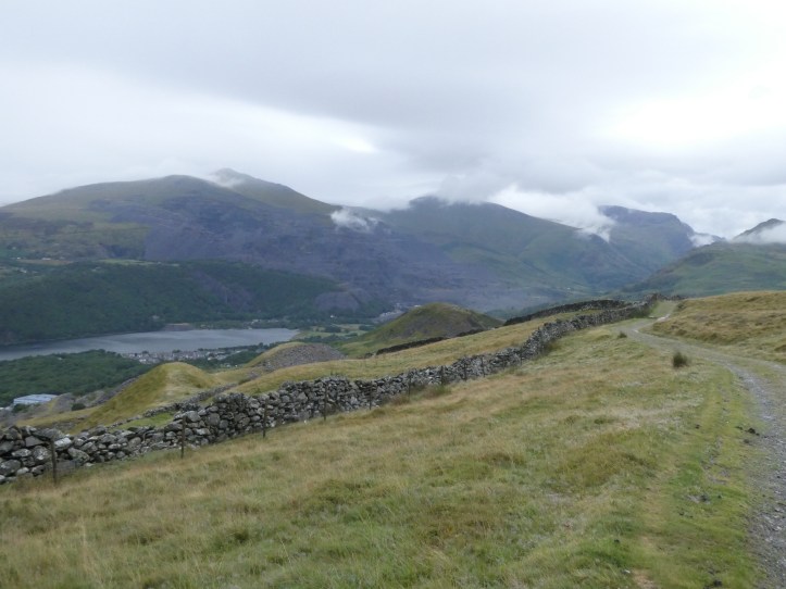
But the uphill, while demanding, was more steady than steep, and we soon found ourselves at the top of the ridge, arcing gently from west to southwest around greater heights.
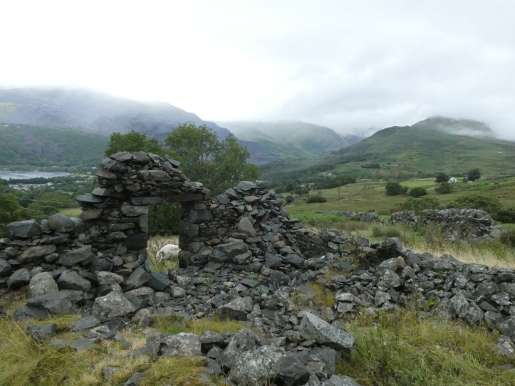
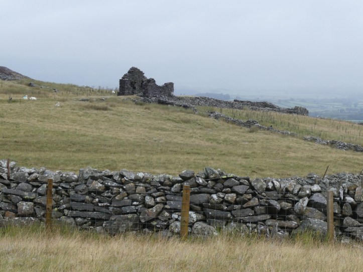
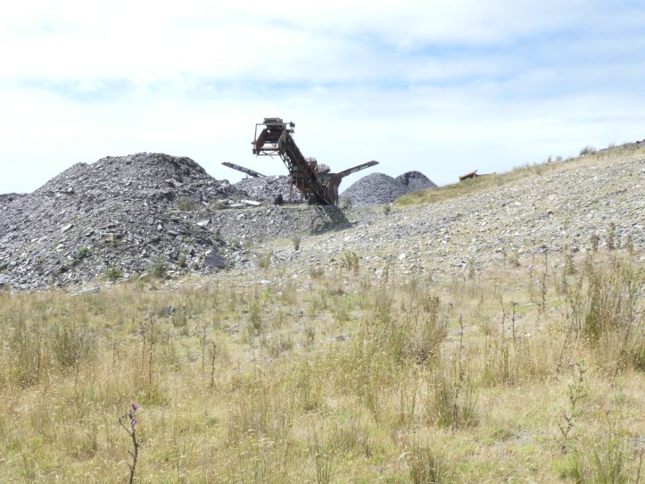
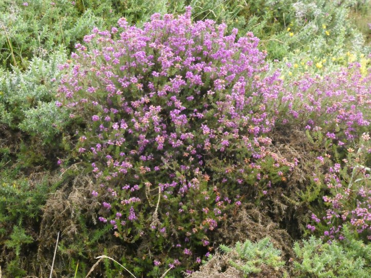
The sheer scale of the slate industry continues to astonish. The landscape was again peppered with massive piles of tailings, the smaller bits of broken slate dumped on hillsides when bigger slabs were carved out of the mountains and hauled down to mills for processing.
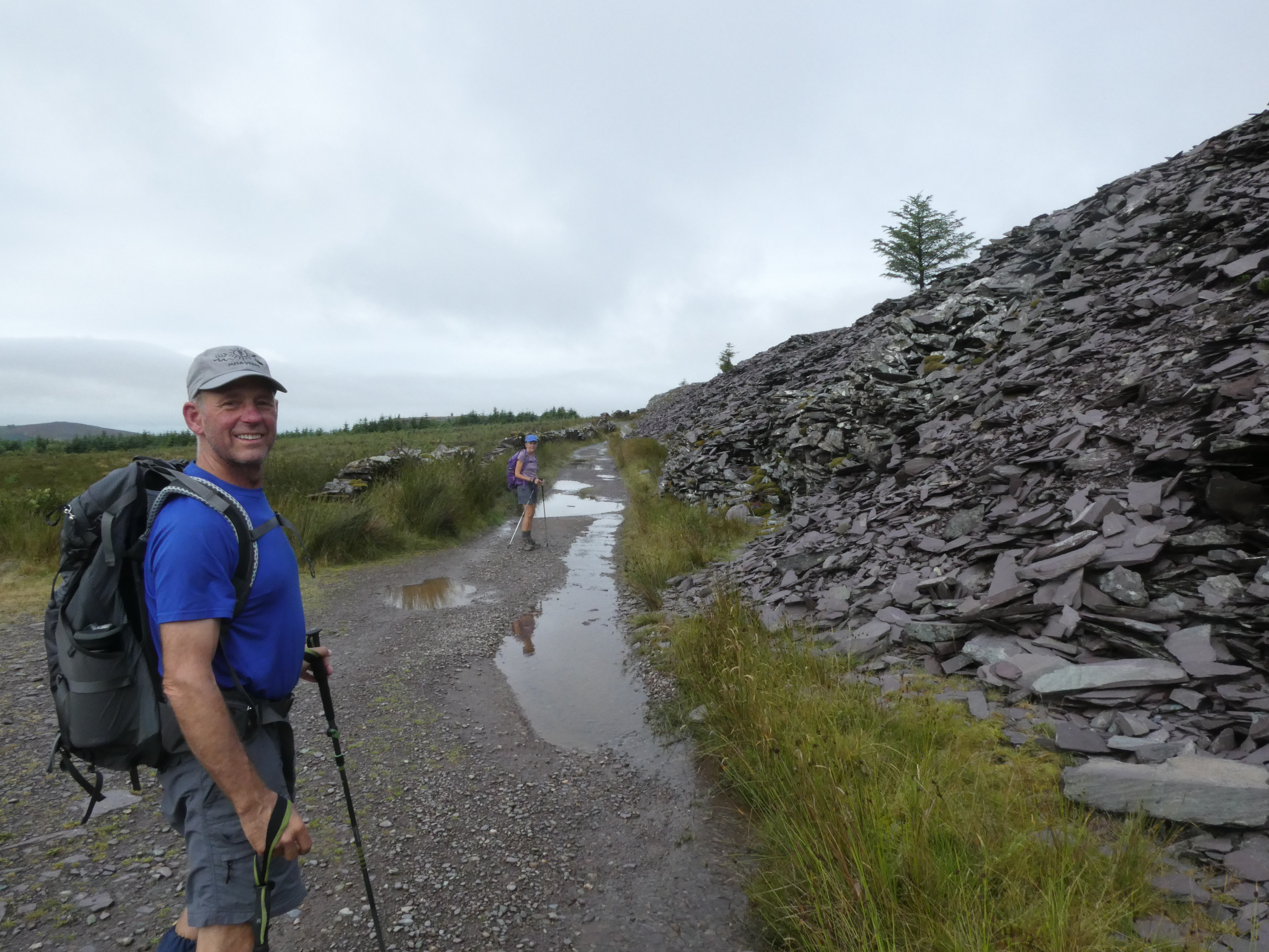
That pile of slate above goes on for several hundred yards and is several stories high, and we saw this sort of thing all day. We also saw, along the ridge, a reforestation effort, with huge areas that appear to have been planted with conifers within the last ten years, maybe in an effort to reclaim some of these hills to their pre-slate industry state.
I’d done a bit of detailed reading of the guide and Google to find that roughly five miles into the hike, we would pass a microbrewery in the town of Waunfawr. This gave me an idea. Our whole day has a built-in complication: We are walking to Y Fron, but staying in Caernarfon down on the coast, because there are no accommodations near Y Fron. So we would be picked up by a taxi in Y Fron, but that meant calling ahead in the morning with a pickup time. We’d left what felt like tons of time and asked for a 3pm pickup, and left Llanberis around 8:30am. So it occurred to me that we had some flex time. The cafe/pub/microbrewery opens at noon on Sundays. If our timing was right, we could stop to try the local beer. And, after the less-than-awful feeling of the first ascent, this was the day’s second happy surprise, which came with a bonus surprise. We descended into a bit of a valley and made our way through Waunfawr, where I dog starting sort of leading sort of following us as we made our way to the Snowdonia Parc, the microbrewery. This dog was not deterred by our efforts to ignore him, or say ‘go home!’. He just ambled along, even on a narrow but busier road, which of course made us all concerned. But we got to the Snowdonia Parc at a little after 11am and agreed among ourselves that it was worth the wait until noon to have a beer since we were going to have to wait somewhere, here or at the cafe in Y Fron where our taxi was meeting us. Our dog pal lost interest and wandered off. We read and looked at maps and kept telling each other what a great day this was turning out to be. Oh, and then the little train went by.
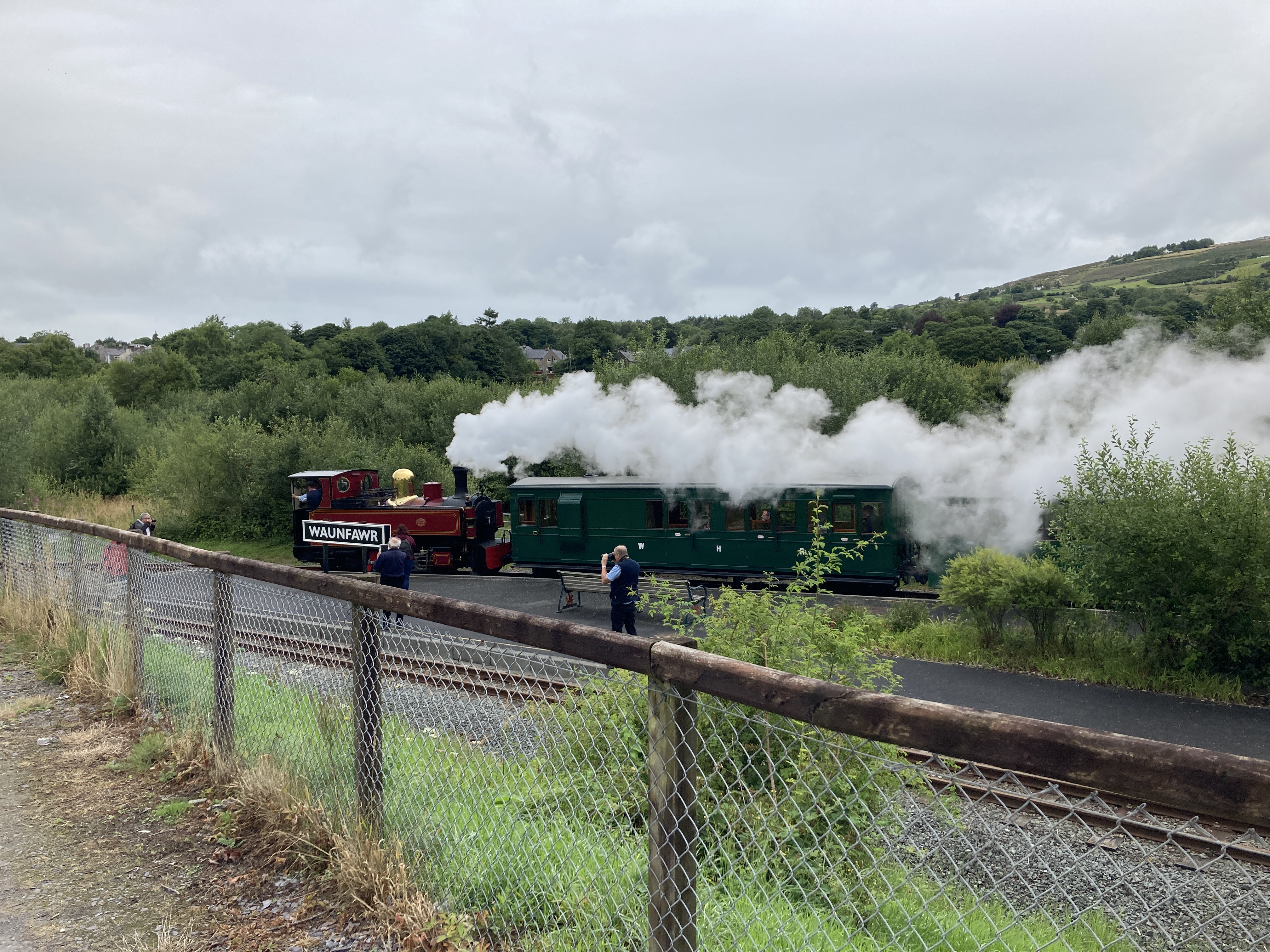
Yes, Waunfawr also has a station on a restored little railway line that runs down this valley toward the sea. The rails had been laid in the early 20th century by a company hoping to join the slate boom, but their timing was off, and the rail line ran briefly in the 1930s before going into receivership. Amazingly, the land was never taken back and the rails and right-of-way remained in place until, in the mid-1990s, another company bought the whole line and restored it and made it into a touristy little train line with an oldtime steam engine. Totally unexpected, totally great.
The pub/cafe opened, and after some consultation with the bartender and generous samples of five beers, we made our orders, then sat listening to classic rock and feeling very pleased with the general state of affairs until around 12:30, when we decided it was time to conquers that last 3.5-4 miles.
Sharp-eyed readers will have noted the words ‘descend’ and ‘valley,’ and will already anticipate what came next. This was the day’s less happy surprise. The steep ascent out of Waun Fawr went up a narrow road, and then plunged into the woods for a rugged climb. There aren’t many photos from this next stretch, because I was taking loud gulping breaths and trying to reassure Tracy and Tim that I wasn’t in fact having a heart attack (their hearty Maine constitutions are such that they barely seemed winded, though they made noises of complaint, mostly, I suspect, to make me feel better about myself). To give an idea:
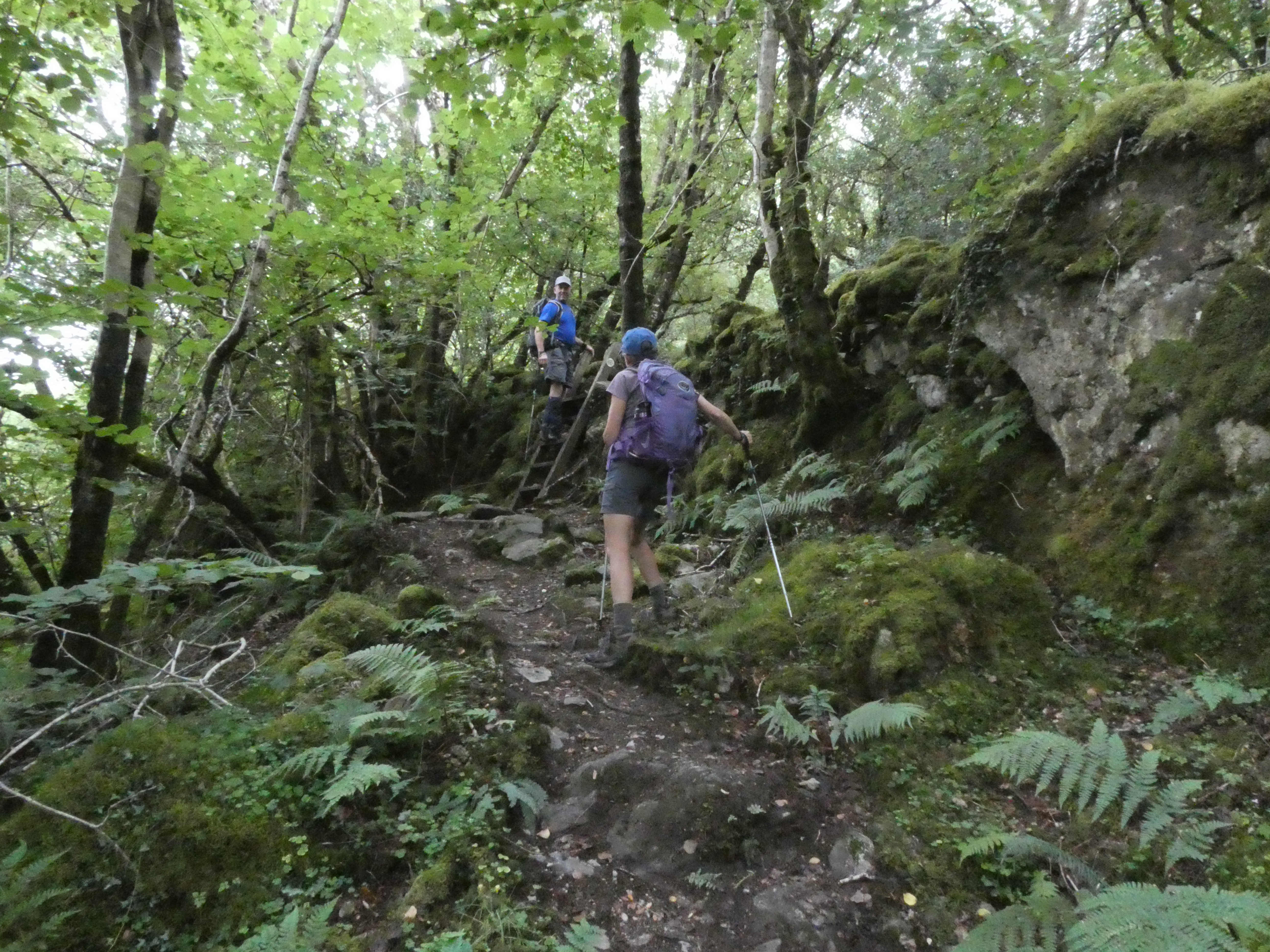
One plus of this climb after a beer break: Part of it involved a tight bit of path through ferns, not as vicious as my encounter on the Wye Valley Walk, but at least now I have two witnesses that fern-walking can be tough going.
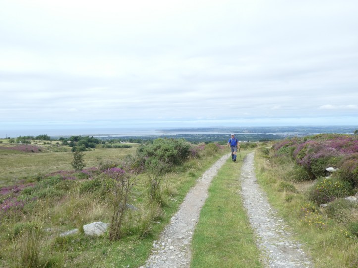
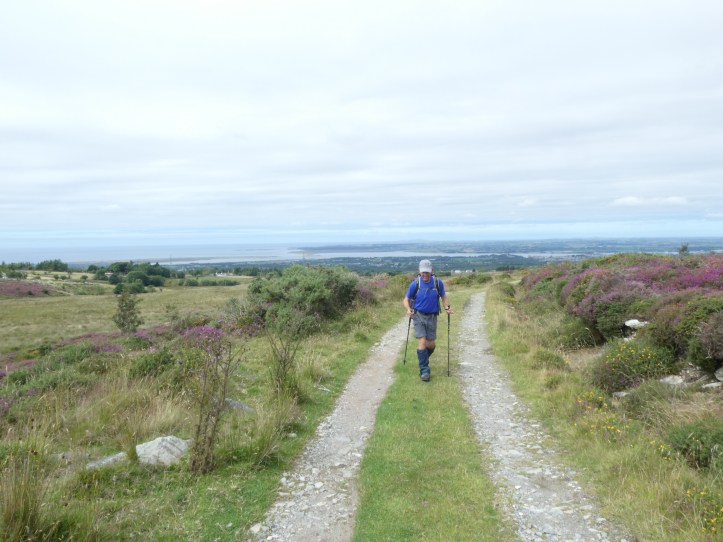
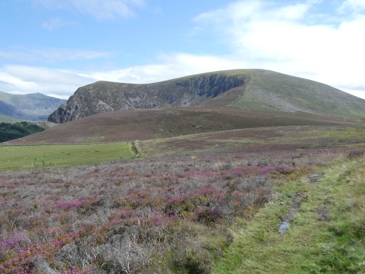
Eventually, we got up out of the valley and the path reached open high ground with great views. Here’s an action sequence of Tim walking. Look at that perfect hiking form!

So far today, the waymarking had been excellent, and we’d had just a few hesitations. The trail paid us back for this with an almost comically badly marked key intersection. After going across open country on a path, we joined a paved road for a while. It came to a point where the road turned to the right, there was an unpaved, metalled road (gravel and rocks pounded down into dirt, but clearly driveable) going straight ahead, and a vague path going off to the left. No signpost. I whipped out my phone, looked at it, pointed down the metalled road, then looked again and got confused somehow, and concluded we needed to stay on the paved road. Off we went and walked happily chatting and oohing and ahhing at the scenery, when a sudden twinge of doubt overtook me perhaps a quarter of a mile later. Out comes the phone, and we are clearly now way off the path. I explained to Tim and Tracy that when I had said at the decision point that I got confused, I was more confused than I thought, and now believed we needed to go back and take the path through the heather and grass. After a bit of confirming by Tim using his phone, back we went to the meeting of ways. We stood and puzzled. I walked up toward the dirt path, and on flat slab of slate on the ground (not something that had fallen over– clearly just a flat boulder on which you would literally walk to start up that path) there was a waymarker for the Pilgrim’s Way, another trail we knew from previous markers was sharing the path for a while with the Slate Trail. And after walking ten or fifteen yards, invisible from the decision point, was a short wooden post with a waymarker for the Slate Trail. Utterly and completely impossible to get this right without either closely watching your map or reading the guide (which, to be fair, does say something like “ignore the road to the right and the metalled way leading ahead and turn left on an unpaved path”).
This last section of the day’s walk gave us a gentle reminder that even a great day involves some muck. The trail became a bit boggy again, not as bad as yesterday’s up above the ankle stuff, but with a lot of zigzagging left and right across the trail to try to stay in higher ground above the stream running down the middle and creating little muddy pools.
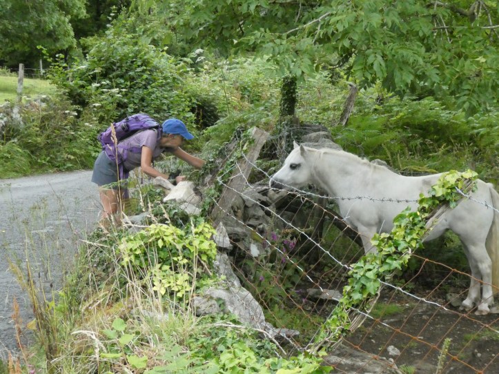
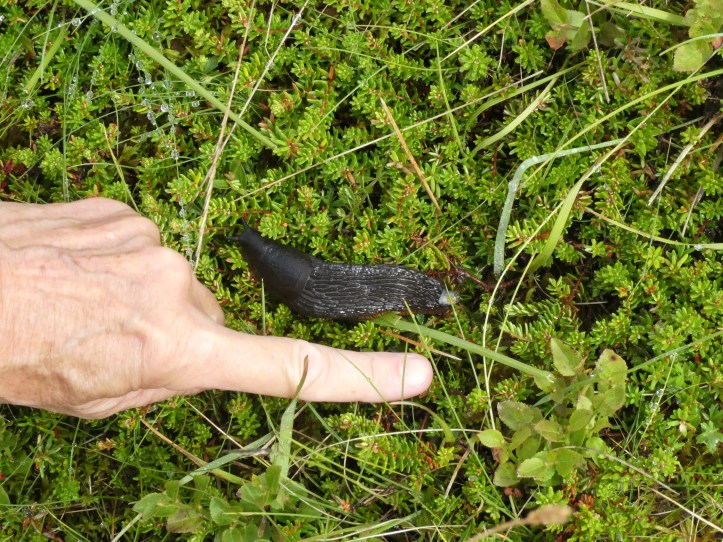
And then we came to a giant boulder, even mentioned in our guide (which we’d all read before this morning’s start but hadn’t much consulted since), and there was a group of people sitting there having a snack. As we approached, one of them said an early hello and asked “Is this your dog?” as our old pal from three and a half miles away came trotting up. “Not ours!” we said. They said the dog had started following them somewhere (gesture back the way we came), so I can only assume that when the dog left us at the pub, he just went on up the trail and found other people to hang out with. He has a collar but no tags, so there wasn’t much we could do but hope that he knows his way home.
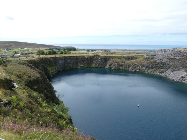
The trail offered a few last surprises, like walking through a seemingly active bit of slate quarrying and past a reservoir that we assume is an old quarry that filled up.
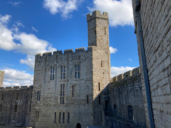
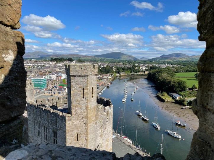
We got to our pickup point, and between our beer break and our slight detour (cough cough) it was around 2:50. We couldn’t have timed it better. Soon our driver arrived and took us whizzing down narrow roads toward the coast and Caernarfon, a fairly big town/little city, which, final happy surprise of the day, has the l most intact castle in Wales (the English put up a lot of castles in Wales in the 1300s to assert power over their newly acquired Welsh subjects). So once we were dropped at our very fancy hotel (it has a pool!), we changed into sneakers and walked down to tour the castle. Totally worth it, and something we never would have even known about if there had been a place to stay nearer to Y Fron. Our cab driver tipped us off that the castle was worth a visit (his other job is working for a scaffolding firm, and he’s done scaffolding in the castle when they are ding repairs).
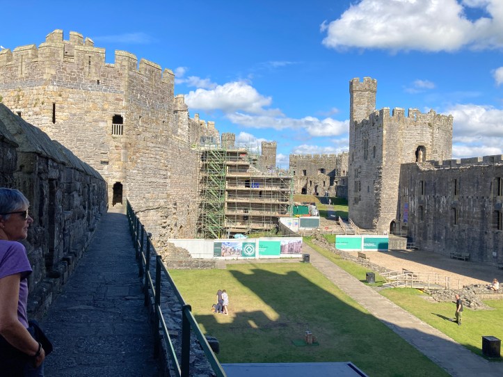

After touring the castle, we retired to the hotel for showers and dinner, which was really quite good (I had pasta with pesto and prawns, mostly for the alliteration).
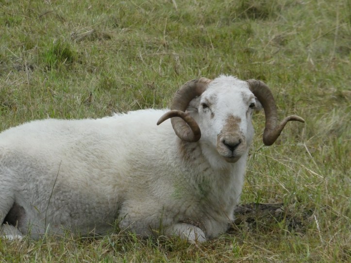
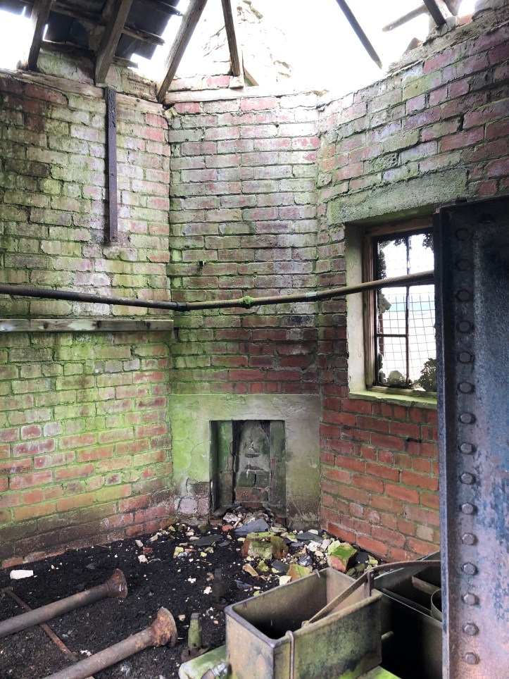
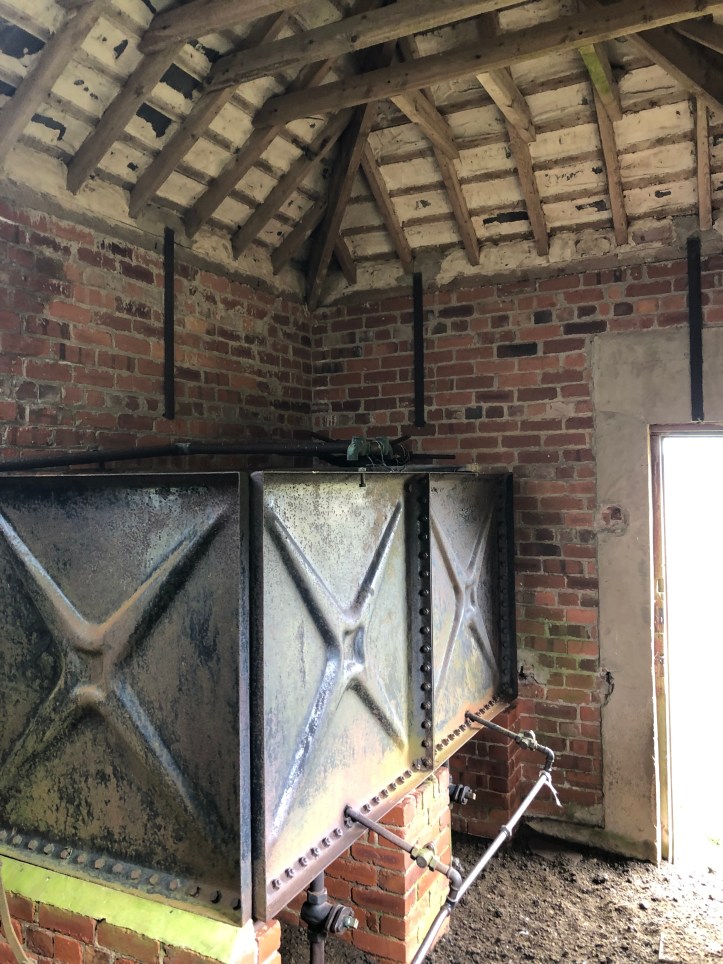
I’ll leave you with two slideshows. One of fun animal and flower moments, and a bonus track of the shack on the high ground from yesterday’s hike that Tim explored and photographed (he shared the photos with me today). Overall, a great day of happy surprises, with just enough challenge and error to keep it interesting.


Looks like a great place to explore!! Great read, thanks for sharing!
Oh my gosh… up from the valley includes climbing a ladder. That’s pretty darn steep!! Phew. Great job y’all!!
And just a little bit of a disappointment that there was no photo of the dog. Especially given the second encounter! 😁