
Look at that dumb, happy face. That’s the face of a man who is ready to face the day’s challenges, confident that he knows what lies ahead, prepared for whatever comes. Chump.
A funny thing happens in the folder of photos I took on July 23. There’s a steady rhythm of date and time stamps for the image files, with little spurts of energy when I try to capture something and take three photos within a minute, then 10 or fifteen minutes before the next photo. And then, after an innocuous photo of a field with a gate at 10:23am, the record goes eerily silent for two hours. Think of it as the missing minutes from Nixon’s White House tapes, or the deleted Secret Service texts from January 6th– the absence speaks.
I had prepared for the hike as I always do, reading the guidebook’s directions for the day looking for the hard parts. The book noted that, after getting to a bridge (the guidebook’s stages of the walk don’t match precisely with the B&Bs and inns where I stay, of course, so getting to the bridge was the last bit of the previous chapter), my hike would start with a steep climb up a hill. Got it. The word steep in guidebook-ese means the sort of hill you pause on several times to catch your breath, something like a 35 to 45 degree incline going on and on. My hostess had, unsolicited, used the same word: “You’ve got a steep hill to start.” Okay, I was prepared for the big challenge of the day, which would come after about a mile of walking. I set off.
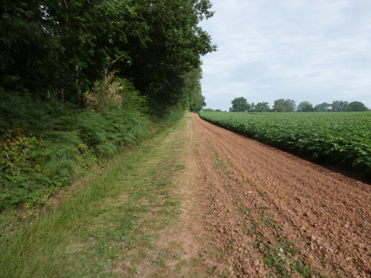
After a bit of walking by a field and through a forest, I started descending toward the river, and there it was, up ahead, the challenging hill.

I crossed the bridge, and after a bit off weaving through a churchyard and up to the pub, the landmark that officially starts this chapter, I headed uphill. Yes, I thought, this is rough, but it’s early in the morning, and after this everything will be easy by comparison.

It’s hard to tell from this photo, but that’s the Royal Mail, uphill from me, walking back down to his mail truck. If you look closely, you can see from his posture how steep this hill is.
After a bit, the path turned off the paved road, passed a little cottage on a footpath, and came into a sloped and crazy meadow bordered with a crazy quilt hedge, where a farmer was working and a young woman (his daughter, maybe?) was walking eight dogs. I head uphill, as the book said, aiming toward what I thought was the next stile. But as I got close, it was puzzling because it looked like it was not a stile but a metal portion of fence with a water trough. The farmer drove up on his four-wheeler and, in a classic farmer move, didn’t say anything like “You’ve missed the turn” or “where are you going?” Instead, he asked if I thought it would rain. I can play this game, so I replied with something like “It looks like it might, but it’s hard to say.” After a bit more of this sparkling meteorological repartee, I said “I’m looking for the Wye Valley Walk. Have I missed a turn?” The farmer point at the winding hedge along the field edge that I had angled away from. “There’s a gate.” I looked at the hedge, looked at him, probably a bit puzzled, then he said “Just down the hill from that fallen tree.” I Iooked again, saw nothing, but decided that if this was some sort of farmer practical joke, I would play along, and so headed back down, where, tucked into a dip in the hillside, virtually invisible from any direction from more then ten yards away, a gate was tucked into the overgrowth. “Phew!” I thought, “I could have gotten a bit lost there!” Ha ha ha ha. I was more innocent then.
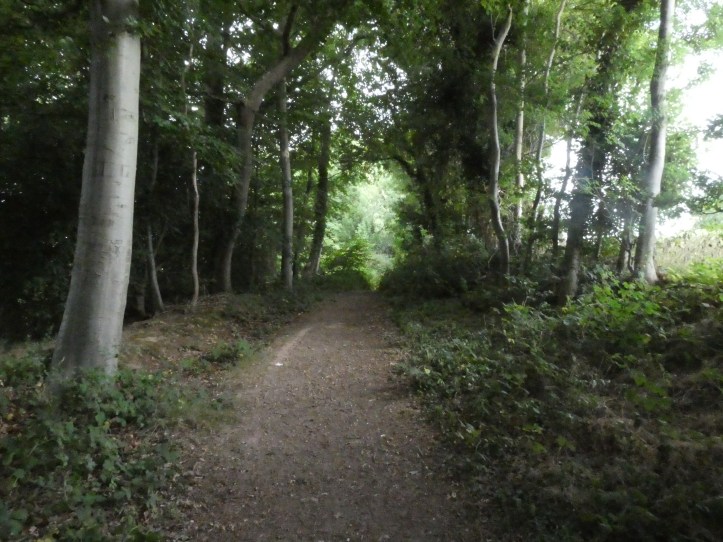
The path continued to climb, rounding the side of the hill and passing a farm, where, tucked into the edge of the wood laced with ferns, I took this badly lit photo.
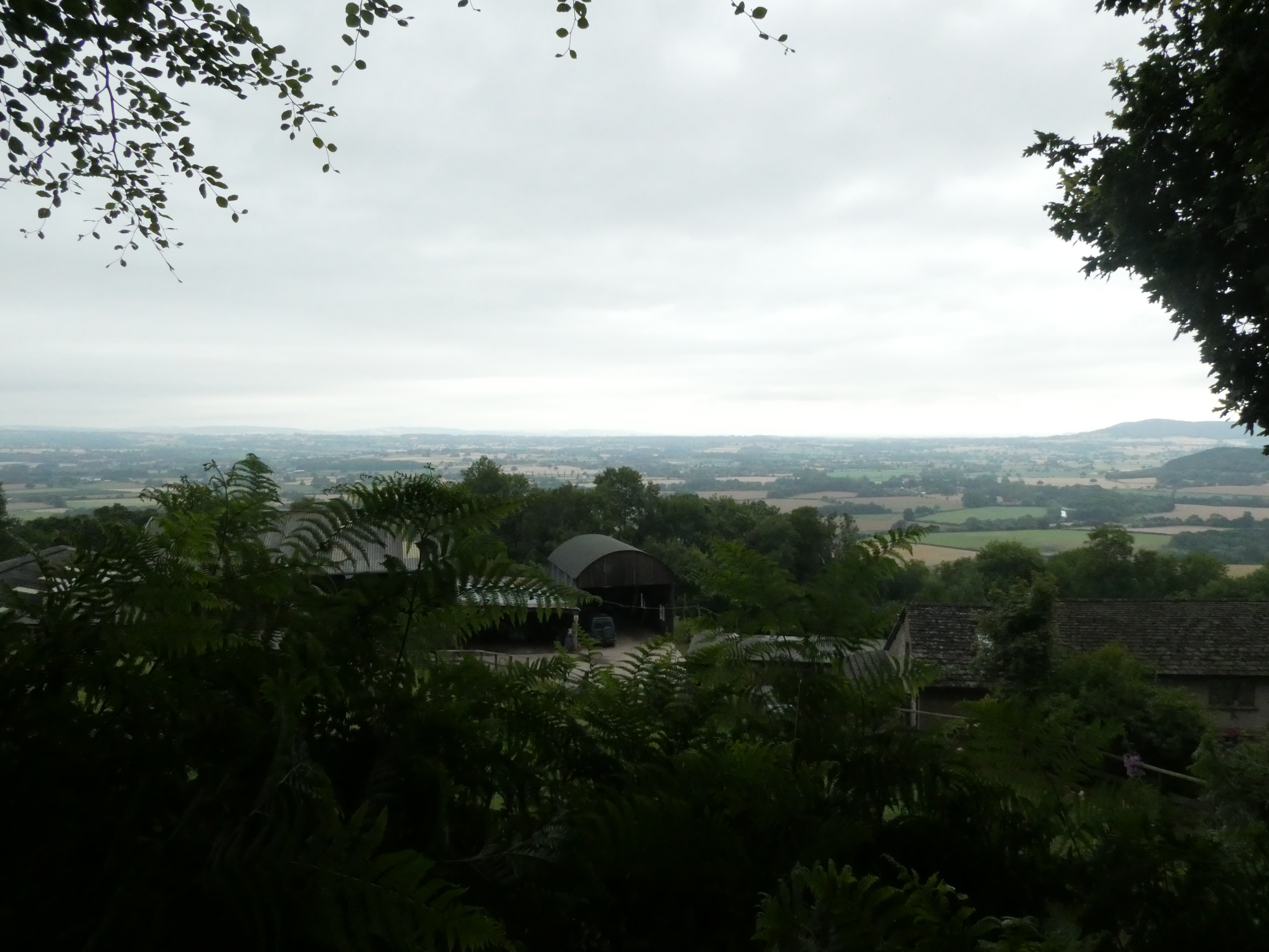
From there, the visual record goes quiet for two hours.
Up through another steep bit, I came to Merbach Common. This is the point where all my innocence was crushed underfoot. Here’s the guide:
“Continue through a further three fields before finally reaching the open expanse of Merbach Common. Go right over the stile here, then left after 23m. This is a permissive route on to Merbach Common and can be used by walkers. The Public Right of Way is through the metal gate straight ahead as you enter the third field. The route bears right just before the summit of Merbach Hill. At a three-way junction not marked on your map, take the right fork and the path starts to descend…”
So, a few things about Merbach Common. 1) Though the name suggests an open field like something out of the opening helicopter shot of The Sound of Music, what appeared before me was a forest of ferns with stinging nettles tucked in cleverly among then ferns. 2) What that anodyne bit of guide-ese does not say, but really should, is something like “DO NOT GO THROUGH THE METAL GATE INTO THE FERN FOREST.” I misread these directions, went through the gate, and plunged onto a very overgrown trail through the ferns. When I had gone a hundred yards or more with the trail feeling very, um, rugged, I was still looking for that right over a stile and then left after 23 meters. And I committed the dumbest of errors. I did not stop my thinking and go back and reread the whole context. I reread that line, and became focused on finding where I could go to hit that bearing right where I would start to descend. I turned back along the fern trail, which was up to my forearms, and, still committed to the ferns after that metal gate, tried another ‘path’ (it is to laugh!) through the ferns. Ferns hold water, so now my shorts, and the pocket where I keep my guidebook pages, were wet, so the directions were now sodden and hard to separate (Yes, in retrospect, I should keep my pages in a plastic baggy in my pocket. Let’s agree that there are many things I could have done differently in life.)
Now I was deep in the ferns, my legs stinging from nettles and the little cuts that sharp ferns can give (outside the context of fern bars of the 1970s, ferns can be quite nasty). I plunged ahead and took out my phone to see if the mapping locator could give me any clue. That suggested a path or maybe small farmtrack (it’s hard to tell on the iPhone’s maps app just what it was) about a hundred yards north of me. I somehow found a way through the ferns in that general direction on another sort of ‘path,’ eventually reaching a T-junction with a real path. A-ha!
Not knowing where on the path I was, I turned left, assuming I would hit that famous right turn to descend. I got out of the ferns at a gate with a marker for the Herefordshire Trail. Well, the guidebook, just a few sentences after the bit quoted about, notes that the Wye Valley Walk and the Herefordshire Trail share the path for a while, so fine. I went through the gate, into a vast open field. I crossed the field, rising to a high point where I was surprised to see a family come through that same gate. I was still a bit shaky on where I was, and I thought to myself ‘I hope they’re not following me on faith!’ After five or six hundred yards, I came to a farm and a gate leading onto a road. At the road, I got out my Ordnance Survey Map and my phone and set about trying to figure out where the heck I was. The family arrived, and I joked that I hoped they weren’t following me, because I was lost. They said ‘oh no, we’re just out for a walk.’ and when I said I was looking for the Wye Valley Walk, they said they thought is was back the way I’d come. Argh. Then they headed on. I stood there puzzling, starting to see that I had come to far and might now have to commit to a return to Fern Hell or to a long complicated diversion down public roads to find my way back to the trail. And then a woman walking her dog came up the road. For a desolate spot high in the hills by a dead quiet farm, this was beginning to seem like a busy place. I explained I was lost, and headed to Hay-on-Wye by the Wye Valley Walk. She puzzled over that. “Well, Hay is down that way,” she pointed to our left. “But you’re trying to get to the Golden Valley? Is that how the walk goes?” She and I peered at the OS map and she tried to get her bearings. Finally, she committed, and said I could either take the road and make a right here, a left there, then a right by the church, etc. OR I could go back the way I had just come and turn left down the hill. Then she went on her way.
Pigheaded, I went back across the field to the gate, and had the twinge of an idea that when I plunged through ferns and met a T-junction and turned left, I should have turned right. So back I went. Sure enough, about twenty yards beyond that T-junction, I found a sign for the Wye Valley Way AND the Herefordshire Way. And then the path turned downhill.
This ate up more than an hour and a lot of my good spirits. There’s nothing more deflating than getting really really lost, especially in something as disorienting as a massive field of ferns. It’s exhausting, because you can’t get your bearings based on landmarks; you’re too deep in the ferns to see anything but ferns.
My boots and socks and shorts and guidebook pages were all now soaking wet, I was tired, and it wasn’t like the day was over– I still had six or seven miles of walking ahead. So on I trudged.

I am sure there are things I could tell you about the next bit of walking, how I made it to a road, walked past a very fancy set of estate gates, how the guide said there was an old motte and bailey castle ruin just off the road that I could just barely see the edge of, how the road climbed and, unbelievably, I missed another turn in the trail through a field and had to do a fancy bit of map reading ten minutes later to work out how to get back to the trail without retracing my steps. (I should pause to note that it is true what they always teach you about orienteering and how tragedies happen: Once you’ve made a mistake and committed to it, you can get into a mindset that commits you to forward motion when you should stop and rethink)
Instead, I will end the day, as the day ended for me, on two happy notes.
First, when I was within a few miles of Hay-on-Wye, I saw on the path ahead a person stopped, standing at what I could see from a distance was a metal kissing gate. I wondered what was up. I arrived to discover she had secateurs and was trimming back the holly and stinging nettle and other overgrowth. She had a cute, sweet little spaniel with her. She clipped away, I said hello, she asked where I was headed, I said Hay, she said I’m going that way too, and we were off in a happy conversation that lasted forty minutes until we got to town. She’s a local, out for a long Saturday walk with her neighbor’s dog (I didn’t ask the details of why she walks the neighbor’s dog; that seemed like prying into her neighbor’s business). She often walks, and, having noted the path was overgrown in some places and at some gates, she’d brought her secateurs. We chatted about long walks, and she told me about doing a charity walk on the Coast to Coast, which I walked years ago with my sister. After my very understated remark that I’d gotten a bit lost on Merbach Common, she recalled a story about a woman who got lost hiking the Pacific Crest Trail, going just hundreds of yards off the trail, but kept moving for days instead of stopping to make her easier to find if search parties were looking (they were). Her body was found months later. Well, I guess that put my Merbach Common adventure in perspective.
My favorite part of our conversation: We were talking about her Coast to Coast walk, and she noted that she went much slower than some people, but that’s because they were walking like it was a sport, with their heads down and their eyes on the time. She was stopping to see things, and stopping to talk to people. “Because I’m gregarious, you see,” she said. This was after we’d been chatting for perhaps half an hour, our walk punctuated by bouts of secateuring and the dog getting distracted by the variety of smells. Gregarious indeed. And right after that, she said, in the nicest way, “Oh, I don’t know your name!” which led to introductions after thirty good minutes of conversation. So, thank you Sarah the dog walker for making the end of my day’s walk so much better than the middle!
I arrived in Hay-on-Wye, where I spent the night in the Firs, a B&B I actually stayed in when I walked the Offa’s Dyke Path. I had only the vaguest memory of the place from 2011, but the town is nice, the room was a good place to lie with my legs in an absolute humming agony of nettle sting and fern cuts, and the gods had one last gesture of kindness for me. The Firs is located right next to a parking lot for the Cinema Book Shop (Hay has a LOT of bookstores, the thing the town is famous for), and parked in the lot was a mobile Pizza Van. So rather than walk around town and find a place to eat, I ate a Hoisin Duck Pizza in my room and collapsed into slumber.
The walk was supposed to be 11.5 miles, but with my stumbling around among ferns, across vast fields, and around roads to regain the path, I’d call it 13 miles. My phone’s health app says it was 17.5 miles, which is amusing but way too high, and based on body gyration rather than GPS.
Tomorrow, a shorter walk and flatter, but wet weather.


Hank, your lost days might be my favorite hike days, and I SO want to get lost rambling with you in a country that talks funny. MIs-directed in the nettle-stinging fern forests, you’re at the mercy of your wits, your rebelling body, the weather, and your orienteering skills. Low grade panic gives way to a tentative solution, which you ultimately conquer. You are the master of your universe at the end of that day. The king of the world! A he-man. (Unless you plowed ahead forward on the Pacific Crest Trail.)
I’m feeling smug now, but man, when I got to Hay, I just got in the shower for five minutes and then lay on the bed while my legs hummed for an hour.
[…] But onward. Chat with two farmers and their dogs, trying to explain why it’s nice to get out of the big city of Chicago to walk in the country, while they both looked dubious but in a nice way. Then up the hillside a bit to follow a meandering path through the undergrowth, including a long section of my nemeses, ferns (for the new followers, please see the 2022 post, Ferns and Loathing). […]