Tuesday, July 2 Malham to Stainforth
Tuesday’s walk was neatly bookended by two conversations along the trail with other solo walkers. I walk alone because I re-energize in solitude, but that doesn’t mean I don’t want to talk to anyone at all. Along the way, a chat as short as thirty seconds, just walkers exchanging their destination for the day, can be very satisfying. “How far are you going today?” “Just to Stainforth; it’s a short day.” “Enjoy the walk along the river.” That’s enough. But sometimes you fall into pace with someone, and, sensing there is more to be shared, walk and talk for a while. It could be only a few minutes, or it could last a few miles. On the Offa’s Dyke Trail, I teamed up with a couple from Australia for several days (!) because our scheduled stops synced up and our temperaments matched. But that’s an extreme example. More often, it’s the chat of five or ten minutes before one or the other signals the end of the chat with some variation on “Well, enjoy your walk,” and slows a bit, or stops to take a photo. If five or ten minutes doesn’t sound like much, imagine talking to a stranger for that long and learning where they are from, where they are going right now, a bit of their personal history (usually just what walks they’ve taken, but sometimes more), but never learning their name.
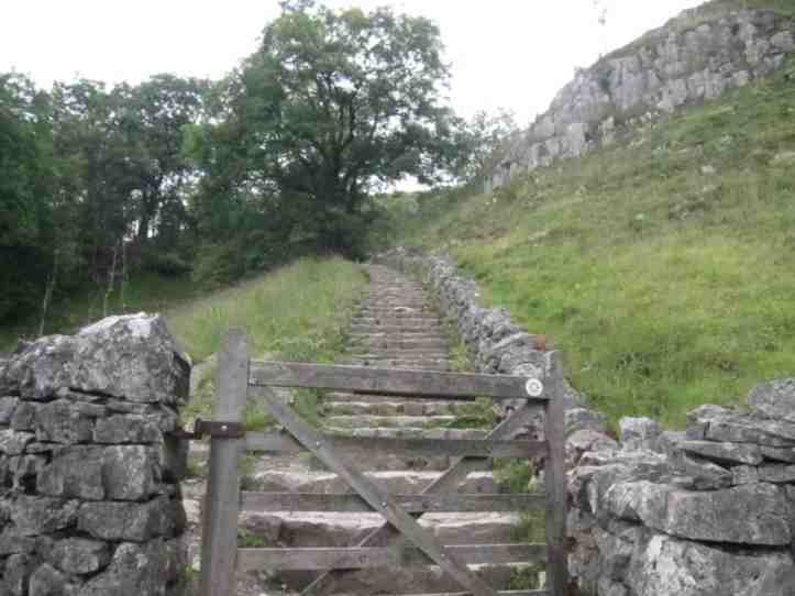
Malham is slightly off the Dales High Way path, so my first task was to get back up to the trail. I say up because I know that after Janet’s Foss, the little waterfall of yesterday, I had continued on the floor of a small valley to get to Malham, while the trail had risen out of the valley. On the plus side, this meant I would get a visit to Malham Cove, a little paradise scooped out of the rockface. On the minus side, at Malham Cove I could see from my maps I would be rising back to the trail by climbing up forty or fifty meters on the irregular stone steps you find on trails that are somehow much more brutal than an actual staircase or stairmaster machine.
This morning’s walk began that way. Shortly after leaving the doggy paradise Beck Hall, after a few hundred yards of road walking, the path turned off the road through a gate onto a dirt track. There I fell into pace with a guy, exchanged the usual first round pleasantries. We concluded by unspoken agreement that we had more to say, so we talked about what trails we are walking (he’s on the Pennine Way, which overlaps and parallels the Dales High Way a bit around Malham), walking with poles (I do, he doesn’t, but he’s starting to consider it, especially because on this trip his knee has been giving him trouble and he is wearing an elastic bandage on it now), trails we have known and loved, things we saw in the last day or two on this trail (Janet’s Foss is agreed to be a nice little break from all the open walking, with a path through trees by a stream). It turns out we’d both walked the Coast to Coast, and we both remembered a particular hard climb in the Lake District. I shared that I had parceled out that climb up steep rocky ‘steps’ by counting out fifty paces, then stopping to catch my breath, and he said he’d done the same. Then we reached Malham Cove, and with that easy end-of-conversation negotiation (he’d walked here before and seen the cove, so he said, “Well, I’ll let you enjoy the cove. Have a good walk.”), we parted ways.
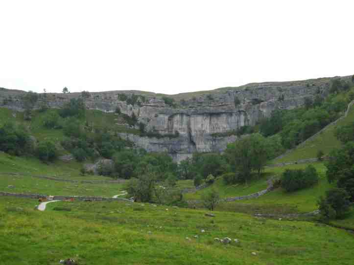
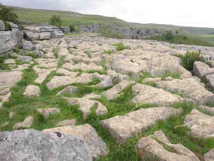
Above Malham Cove, after a grunting climb up those steps (it’s twice as long as it looks), I reached my first view of the amazing limestone ‘pavements’ that are a feature of this part of the Dales. The rain, which is slightly acidic, falls on big flat areas of limestone exposed by that ancient geologic upheaval that created the dramatic east-to-west line of cliffs. It forms pools that slowly, over centuries and millennia, eat at the rock, forming what looks like a landscape of stone molars.
And here I made the sort of fortunate mistake that proves that God loves walkers and fools and loves walking fools doubly. There are no trail markers up here. As I’ve noted before, the Dales High Way is poorly marked, trusting that anyone walking will have a map or knowledge of where they are going. I had a map and the torn out pages of my trail guide describing the path. But I was distracted by the pleasure of my chat with my fellow solo walker, the beauty of Malham Cove, and the oddity of the limestone formations above it, that I got sloppy. I saw a group of young hikers on the path ahead and followed, letting them bolt along at their vigorous pace but seeing that there is a clear, distinct path they were following.
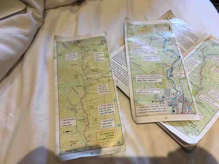
As I noted, the Pennine Way and the Dales High Way and several other just local paths all weave around in this part of the Dales, and the marking is, to be kind about it, intermittent. After perhaps 1000 yards of walking, with the young hikers now far far ahead, it occurred to me to check my directions. Hmm. They didn’t seem to match what I was doing. Where was the sharp turn to the left the guide described? And shouldn’t I be coming up on the ‘hard ascent on a rocky path’ by now, instead of walking through easy open fields of wildflowers? But I forged on, knowing I was going in generally the right direction, and seeing from the trail guide that the path should hit a road. If I came to a road and worked out that I had hit it at the wrong point from taking the wrong path, I could easily correct course. And that is exactly how it played out. Despite being a walking fool, I knew enough about reading maps, both good topographical maps and the rough one drawn in the trail guide, to get it right. I’d been on a bit of the Pennine Way that runs parallel to the Dales High Way. But the Pennine Way route here is easier. I’d cut out the rough ascent in favor of a pleasant rise across fields.
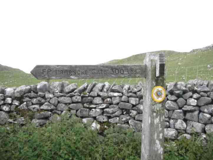
Off I bolted toward Langscar Gate, as smug as if I’d blazed a new trail myself.
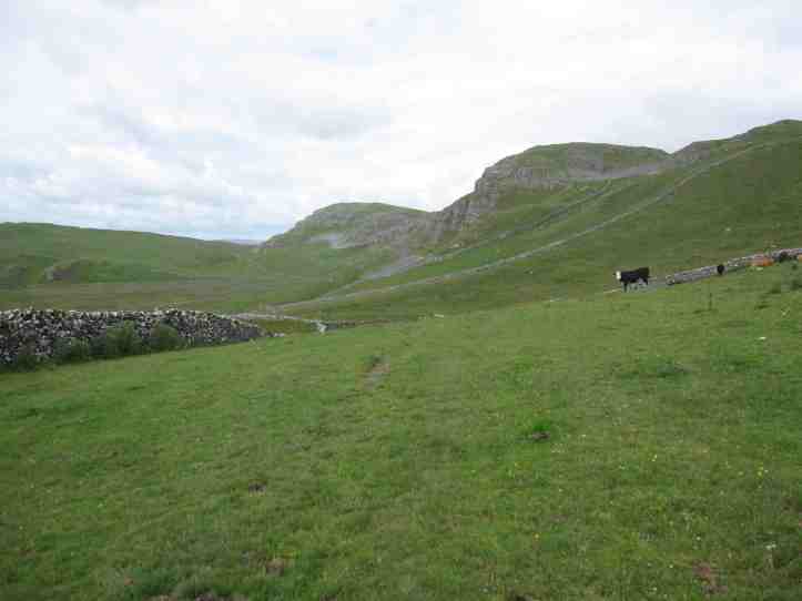
The trail for the rest of this day is past more amazing exposed limestone cliffs, and in this part of the Dales there are caves.


Today’s walk was full of terrific wild landscape for twelve miles, but for me there is an important moment of civilization. The path drops down off the hills into the town of Settle, which is pretty darn large by Dales standards. Having experienced the unfortunate destruction of my plug adaptor, I had done a bit of online research to determine that, if the Boots Pharmacy website was right, the Boots in Settle had USA-UK plug adaptors. I’d worked out that the Boots is just a block off the path, which goes through the center of Settle. Plan in place! Since the fact of my writing this makes it obvious, I won’t drag out the suspense.

My walk was also well-timed. I’d hit Settle on Tuesday at lunchtime, and Tuesday is open market day in Settle, so I bought a nice beef pasty (that’s a meat pie you can hold and eat without too much mess because it’s made to be firm, not drippy) and watched the people.

After Settle, the path turns north and follows roughly along the side of a river to get to Stainforth, my stopping point for the day. And on this part of the path, I had my second perfect chat with a solo walker. It’s a narrow path, and I heard someone coming up behind me. If you sense on a narrow trail that someone is coming up behind who is faster, it’s common courtesy to find a place to step aside and let them pass. So I did that. Instead of passing, he stopped to chat. It turns out he’s not only a serious long-distance walker; he also blogs about his walks. A man after my own heart. And he was genuinely puzzled and impressed that I’d even heard of the Dales High Way. “It’s a bit esoteric, when it comes to walking paths,” he said. We talked about various paths, and after perhaps five minutes of good chat, we finally exchanged names and websites. So, hello Neil from abitofawalk.uk.
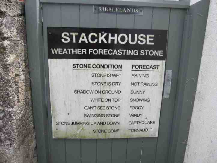
Because Neil had places to go, with a goal of getting to Ingleborough (which, in retrospect, means Neil is some sort of walking cyborg, since that means he had another nine or ten hard miles to do when we met at 1 or 1:30pm), so he forged ahead, and I followed at a more leisurely pace, knowing I only had a few more miles along the river to get to my stopping place in Stainforth. Which eventually I did. But along the way I passed a sign that proves that certain jokes have become standard issue– we saw this same sign, with different place name, on the Hadrian’s Wall Path.
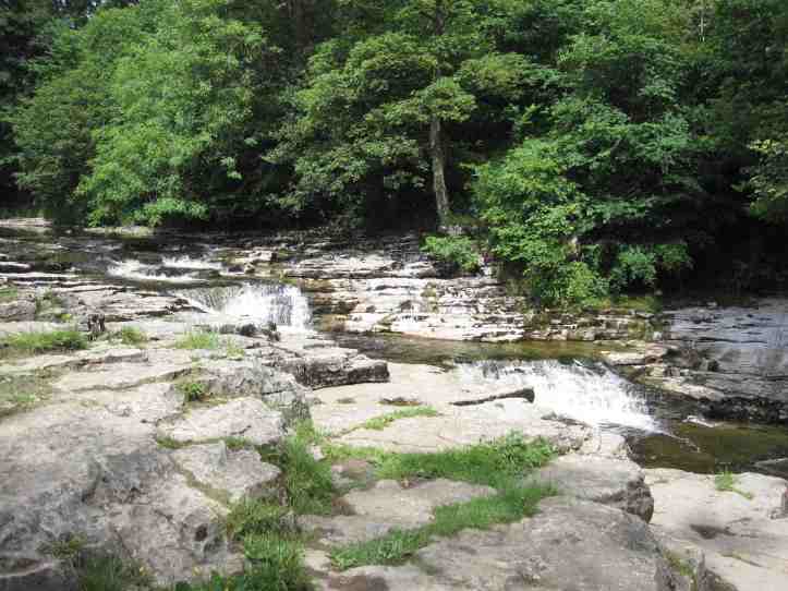
And then I came to the turnoff from the path to get to Stainforth, marked by this little waterfall where people come in September to see salmon make their way upstream to spawn.
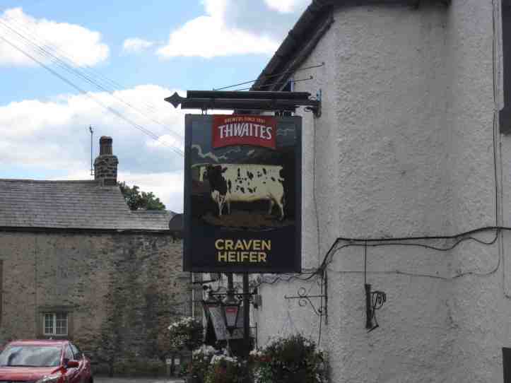
And finally I made it to my stopping place, tired and happy. The Craven Heifer is everything you’d want in a pub/B&B called the Crave Heifer.
Tomorrow’s walk features the dreaded Ingleborough, one of the dreaded Three Peaks of the Yorkshire Dales. A whole lot of up followed by some scarily fast down. But that’s a story for Wednesday’s post.

Carry on👍🏻
Sent from my iPhone
>
Hi there Hank. Just found your blog randomly and enjoyed reading about your walk. I’m a solo walker too, and prefer walking on my own, but love chatting to other walkers that I meet along the way. Snap. 😄