Day three was supposed to be our easy day, with just eleven or so miles of walking. Whelp, we did less than that, but it didn’t end well.
The morning started with a nice breakfast and a chance to use the inn’s wi-fi to finally post day one. Then off we went on another misty morning (This trip is payback for all the ridiculously sunny trips I’ve enjoyed). We walked down to the lifeguard shack at the beach at Porthcurno and found the trail again, leading, of course, up a hillside in a fast ascent. The makers of these walking paths along coasts love fast ascents and descents.
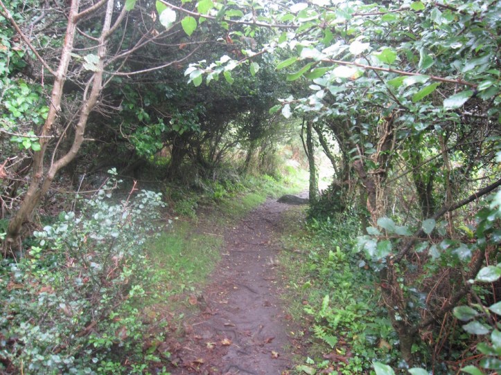 The morning was cool and windy enough that I took off my cap for fear of losing it. But the walking once were up top was pleasant and the trail not too bad. However, there were a lot of side trails, and we felt watchful for markers. But all our watchfulness didn’t matter: At a key point, a trail wandered off to the right, toward the water, and we stayed on the straight path. That path soon joined up a farm road between hedges , and I was saying to Karen how glad I was that she would get to see that the paths aren’t all seafront and cliff—walking through farms is part of the experience.
And then, like a miracle, as we approached a farm we met an old bearded man in raingear (waders that made him look like a fisherman, though he could have just been headed out to the wet fields), who asked “Are you lost?” We replied that we weren’t sure, we were looking for the Coast Path. He explained in some detail about the marker that had, for what reason he knew not, been removed. It was a long long way back, so we were very happy when he advised us to walk through the farmyard, up the drive to the main road, turn right, get to the campground on the right, and head back toward to cliffs, where we’d rejoin the path. He also said we’d missed a difficult bit by our detour, so we didn’t mind the extra mile or so we probably added.
We trekked onward, passed through a grim-looking campground. (Is there anything grimmer than a few camper trailers parked in a big wet campground on a rainy day, with an unused playground and weary campers heading to and from the shower rooms?)
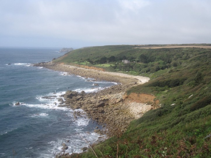
The markings on the side trail practically shouted that we were now heading back to the Coastal Path, much to our relief. The path gave wonderful cliff views, varied with sections between hedges that gave some relief from the wind even if they took away the views. One stretch involved about fifty yards of walking along a shore of boulders, stepping from boulder to boulder and watching for the place where the trail headed back up the hill.
The day was gradually clearing, making for pleasant walking. And then we came to Lamorna Cove. The descent was very challenging, steering around big boulders that jut into the path. We watched a couple whom we had passed and who had passed us a few time (as their stops and their faster pace, our stops and our slower pace, made it seem like a neck and neck race) scramble down ahead of us toward this dramatic little beach.
We made it to the beach and the few houses nestled in this tiny valley, and headed back up the other side to regain the heights (simple rule of coastal walking—any little inlet or cove means walking down fast then crossing water then going up fast).
On this unusually rocky section of path, slick from the mist, I took a fall in slow motion, going first forward onto my knees and then fully down. Thank heavens for the walking poles, which kept it from being much worse. But as I slipped, I twisted my ankle.
We had to make an assessment: Was I okay to go forward, or should we descend the few hundred yards back to Lamorna Cove and figure out transportation forward? Just how bad was it. I urged heading forward, hoping that it was a trauma that would pass. So I hobbled and Karen walked for a while, until I decided I definitely needed to wrap the ankle with an Ace bandage. We stopped and I wrapped it, and then set off again for the two-plus miles to the town of Mousehole, where, Karen affirmed in her trail guide (she has a different one than the one I carry sent by my trip bookers, which makes for useful compare and contrast exercises), we could get a bus on to Penzance, cutting off about four miles of road walking.
The next few hours were a slog, since I was trying to go easy on the foot while walking on uneven ground and sometimes climbing up or down rock steps or long tricky muddy hills. Karen was patient and encouraging even with my frequent stops (I think we stopped four times in two hours). The tricky part was that the pain could come unexpectedly as my foot went just slightly wrong, so I was on guard the whole time. Slow waking does give you time to think about future solutions, and I was already thinking about the strong likelihood that Wednesday would not be a walking day. The very good news, I suspected on the path and confirmed later, was that if we were going to take a day off and use buses, we could hardly have chosen a better day. On Wednesday, we’d be passing by St. Michael’s Mount, a cool place that I had wondered if we’d have any time to stop and see. Well, if we’re uses the bus and taking a day, we can do it!
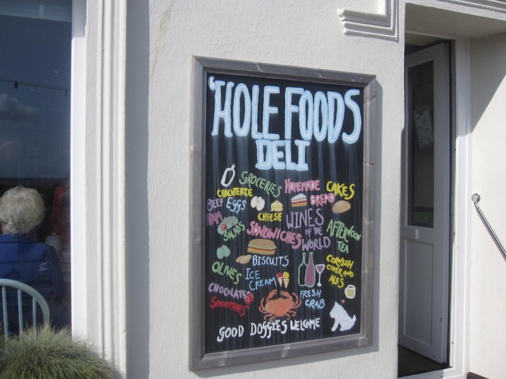
The last stretch of the path, after a lot of groaning and wincing, was a road descending into Mousehole (pronounced mow-zel), which was at one time one of the quaintest Cornish villages in existence (at least according to Dylan Thomas, who called it the loveliest village in England). It’s now a crowded tourist attraction of tiny narrow streets and shops punning on mouse or hole. (The Cat and Mouse Gallery, Hole Foods Café, etc.) For me, the tough part was that the ankle pain was worse on pavement heading downhill, and we had about half a mile of going down a steep paved road to get to town. Just awful. Then Karen, my Florence Nightingale, went into a shop and got Cadbury bars and a Diet Coke for me, and we sat for a while to rest before catching the bus (a tiny bus, designed for the tight roads of this area) to Penzance.
 The landlady of our very nice B&B (a perfect time to finally get a really good B&B, after two discouraging night) had an ice pack she let me use, which helped some with the ankle. We headed to the nearest food, a good Thai restaurant (though I’ll quibble with their use of the same not-rice-noodles for pad thai and pad see ew), and headed back to the B&B, where I spent time on the internet working out bus schedules for tomorrow.
It’s early morning now, and the ankle is definitely feeling better, but does need a day off. So, a day of light walking and touristy stopping at St. Michael’s Mount is just the thing to get me recovered for another eleven days of walking.

Hank fingers crossed that the ankle continues to improve after a day off. I thought I was the only sibling with the ‘falling’ gene – darn! Photos and words still describe a wonderful journey so far.
love hearing about your trip since not so many generations ago my family was in Penzance
This walk sounds a wee bit challenging!
Stay off that ankle til it’s good to go Hank and enjoy the bus rides and the sights. The photos in your blog are FABULOUS😄